 Route Editor

| Guide | ♦ | 14 Triplogs | 2 Topics |
details | drive | no permit | forecast | 🔥 route |
stats |
photos | triplogs | topics | location |
| 114 | 14 | 2 |
The Real Lost Soldier by Hansenaz   Note NotePage stats reflect actual one-way segment #83. The description below takes you a little further down to Cottonwood Camp for 11.5mi. Refer to this route. Soldier Camp Trail was apparently a prominent destination in years past but not so much anymore. Classic AZ Hiking guides up through about 2000 described the hike and how it could be used as part of a long backpack circumnavigating Four Peaks. (Don't try it!) The trail is still prominently labeled on an official government website for the Four Peaks Wilderness, though it's elsewhere stated that use is "very light".
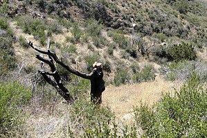
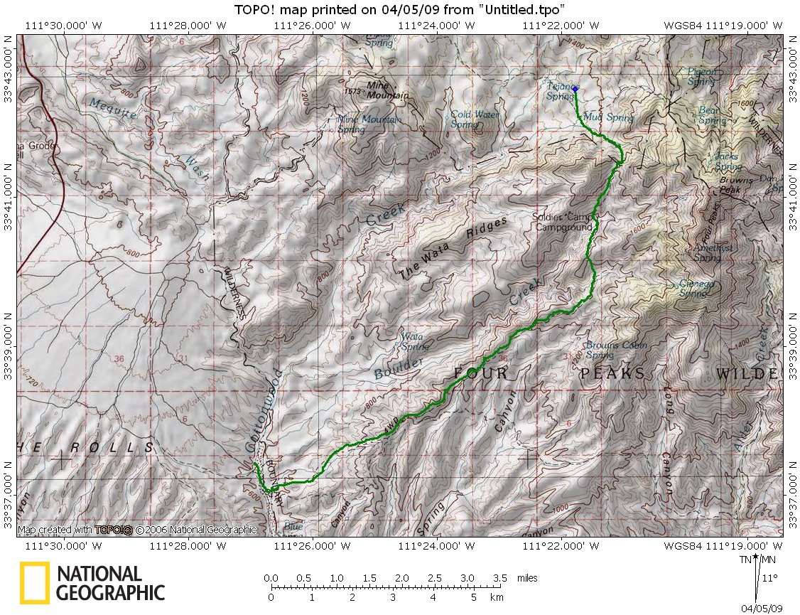
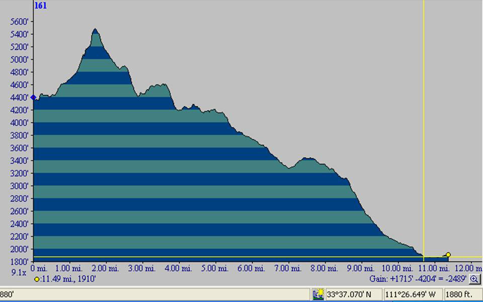
But there could be a lot to recommend this trail. It crosses the entire western flank of the Four Peaks area in a seldom-visited scenic desert country. Though the prominent roads accessing the area are full of noisy motorized recreationalist, the trail is almost entirely within the Wilderness area where it's hikers (and horsemen) only. I found that with a little preparation and a good plan it can make a nice dayhike in 2009. The plan is to do the trail as a one-way (downhill!) shuttle hike and by preparation I mean have a GPS with trail information or a good map and some navigation skills: don't expect an obvious path to take you all the way. Start at the Mud Springs Trailhead and take the prominent trail. Your first target is Big Saddle which rises above you to the southeast. The trail is pretty easy to follow though I did lose it for a while in the first 15 minutes....here (and several times later) the trace for Soldier Camp Trail visible on my Garmin GPS map helped me quickly get back to the trail. It climbs a small central ridge toward Big Saddle keeping just left of a barb wire fence much of the way. A few hundred vertical feet below the saddle, the trail seemed to end in a steep loose ravine. I clawed my way up and gained the nice saddle (1.5 mi, 55min.), but saw I was 100-200 yds east of the low point which seems to be where the trail is supposed to come in. Perhaps a better way up can be found right off the loose ravine. From Big Saddle you can see down Boulder Creek and the way ahead. Looks good! For the next couple of hours, it's a matter of enjoying the open country while keeping your eyes open for cairns. About 2.8 mi in, on the descent to Boulder Creek, you pass Soldier Camp, a slightly flattened area on the descending slope with a prominent tree. You can tell it's a noteworthy site because there are signposts (but no sign). The trail then crosses Boulder Creek and climbs out of that drainage on the east side. It crosses a small ridge and gets a little bit hard to follow before crossing another drainage featuring a large cairn with a bowling ball(!). After a low climb out of here, the main ridge is gained and you get a commanding view down Cane Springs and toward the Superstitions. It's a nice feature of the trail that it tends to stay on ridgetops where possible. At 8.2mi (4hrs 15min) you pass some naked signposts and see a jeep road (FR401) ahead. This is nominally the Soldier Camp Trailhead though you need tough 4WD and a fair amount of determination to drive there (it is outside the Wilderness boundary). Continue down the jeep road about 0.5mi, keeping your eyes open for the Lower Soldier Camp Trail which forks to the right. Going around the corner you can see Cottonwood Camp (your destination) as a clearing down at the bottom. The trail is an old jeep road (though in the Wilderness since 1984, it's now overgrown) which is at first steep and rocky. At the large cairn go left and generally head left as you descend and cross a few washes. At 11.0mi (5hr 20min) the trail/road crosses a fence at the Wilderness boundary about 0.5mi short of Cottonwood Camp. There is no sign at all to mark this end of Lower Soldier Camp Trail: just an ATV road turning into an overgrown jeep road at the fence. It's a few hundred yards north of FR401 which stays on the ridge. Cottonwood Camp is easily reached by following the various tracks (north eventually) and across Cottonwood Creek (flowing but walkable in Apr. 2009). If you left a shuttle vehicle here, it's ca. 20mi back to your car at Mud Springs Trailhead. A few obvious warnings: the trail starts high and cool but descends as the day goes along. Expect Phoenix-like temperatures at Cottonwood Camp so this is a cool weather walk. There are no signposts and the trail is far from obvious: know where you're headed. Also, the trail is quite overgrown in spots so prepare for catclaw, teddy bears, and numerous other sticky things: long pants are essential!
Check out the Official Route and Triplogs. Leave No Trace and +Add a Triplog after your hike to support this local community. One-Way Notice This hike is listed as One-Way. When hiking several trails on a single "hike", log it with a generic name that describes the hike. Then link the trails traveled, check out the example. | |||||||||||||||||||||||||||||||||||||||||||||||||||||||||||||||||||||||||||||||||||||||||||||||||||||||||||||||||||||||||||||||||||||||||||||||||||||||||||||||||||||||||||||||||||||||||||||||||||||||||||||||||||||||||||||||||||


