Route Editor

| Guide | ♦ | 22 Triplogs | 3 Topics |
details | drive | permit | forecast | route |
stats |
photos | triplogs | topics | location |
| 396 | 22 | 3 |
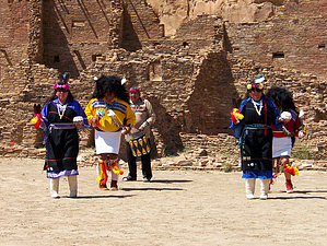
One of the largest Anasazi ruins in the SW! by PaleoRob  The trailhead is at a small parking area to the southeast of the ruin itself. Park there, and pick up the trail guide. Its handy and free, unless you want to take it home. It contains lots of neat information about the ruin and the Chaco culture that flourished around 800-1100.
Following the gently curving eastern wall to the north, you come to a boulder-fall. This is the remains of an enormous towering pillar called Threatening Rock that had been threatening to fall for years, and finally did in 1941. Before it fell, however, archaeologists had a chance to study it and the rooms it fell on. It seems that the Anasazi attempted to slow down the erosion of the pillar by building a retaining wall under it. From the stop numbered 2, you can see the remains of their wall. Atop the boulder fall, further along, you can get an excellent glimpse into the heart of Bonito, and see the symmetrical geometry of the pueblo. This is the highest point on the trail. From the overlook into Bonito, the trail descends into the space between the cliff face and the northern wall. While the southern wall is a true east-west surface, the northern wall is a gentle curve, sloping down to form the eastern and western walls. From stop 5 there is a break in the wall, allowing a good glimpse into the internal construction of the characteristic Chacoan Core-and-Veneer masonry. Some rooms at Bonito may have been built as high as 4 or 5 stories, and these massive lower walls were well equipped to handle to load. After leaving station 7, the northernmost section of the trail, you cross into Pueblo Bonito itself, through an old entryway that early explorers created. You are amidst a large section of room blocks once you enter into Bonito, and this is the oldest section of the ruin. This section of Bonito may have been constructed as early as 850AD. Moving on from the room block, you then move into the eastern plaza. Here you can see the Great Kivas and the dividing wall that runs down the center of the plaza of Bonito. Crossing over the dividing wall, you pass directly by the western Great Kiva. Stop here and read the informational booklet - it goes into great detail on the structure and function of a kiva at stop 9 and stop 10. Between 9 and 10, however, take the chance to explore the western plaza, including the southwestern corner. It was here that early archaeologists found evidence of an ancient ponderosa pine that the Anasazi at Bonito tended carefully. Its significance is unknown. Moving back across the wall to the eastern Great Kiva and stop 10. There are benches here on the plaza to observe the kiva from. This is also where the daily ranger walks of Bonito are held - its quite an eerie sounds to hear an ancient conch trumpet being blown and echoing across the canyon when the ranger talks start. Moving on from the plaza, the trail takes you into the heart of the southeastern section of Bonito, where the majority of the complete rooms remain. Here you can stop and view ancient roofs, plaster, mealing bins, and an archaeoastronomical marker - a corner door. Look on some of the roof beams (latillas and vigas) for round marks. These beams were sampled for tree-ring dating in 1991. These showed cutting dates no later than 1082AD - and those beams are still doing their job today! The trail follows the famous "line of doors" along the southern wall before exiting the ruin. Two large mounds are visible just to the south of the trail and ruin. These were originally surfaced and flat-topped, with an unknown function. The Great South Road, one of the famous Anasazi "roads" that lead from Chaco Canyon, originated at Pueblo Bonito, passed between the two mounds, crossed the canyon to Casa Rinconada, and then climbed up the far mesa. From Casa Rinconada, the stairway leading to the top of the mesa can be seen - similar to the Jackson Stairway behind Cherto Ketl. Once out of the ruin, follow the trail back to the parking area, or take the Petroglyph Trail along the cliff face towards Cherto Ketl. Chaco Canyon is very hot in the summer, and there is no water except at the campground and visitor center. Carry more than you think is necessary, especially when the weather is warm. Its a long way to get help or water. Check out the Official Route and Triplogs. Leave No Trace and +Add a Triplog after your hike to support this local community. | |||||||||||||||||||||||||||||||||||||||||||||||||||||||||||||||||||||||||||||||||||||||||||||||||||||||||||||||||||||||||||||||||||||||||||||||||||||||||||||||||||||||||||||||||||||||||||||