Route Editor

| Guide | ♦ | 14 Triplogs | 0 Topics |
details | drive | no permit | forecast | 🔥 route |
stats |
photos | triplogs | topics | location |
| 233 | 14 | 0 |
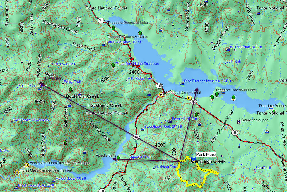
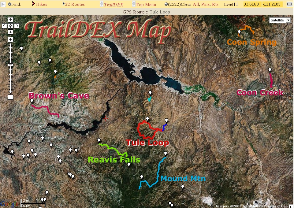
Peak+Ridgeline+Canyon=Fun by gpsjoe   Overview OverviewTule is a scenic loop hike that takes you up to Pinyon Peak at 5,240 feet revealing some great views of Roosevelt and Apache Lakes, Four Peaks, and all surrounding mountains. After the peak, Sun_hiker and I hiked across the ridge on the 2 Bar Ridge trail to the Tule trail where we dropped down into Tule Canyon and hiked 3 miles in the Tule Canyon to get us back to our vehicle to end the 11.8-mile loop. This is a delightful mixture of a peak, a ridgeline, and a canyon. Hike Along the loop at 0.85 miles of hiking on FR83, we reached the 2 Bar Ridge Trailhead & Parking Lot. There are no issues hiking on the road. The reason we parked 0.85 miles before the actual 2 Bar trailhead is to do the 500 feet of elevation in the morning rather than at the end of the hike.
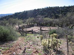
At 8.1 miles we reached Tule Canyon at a Coral there hiking on the Tule Trail. The first part of the Tule trail follows a scenic ridgeline. It then begins a steep descent through a rocky channel and goes on using a narrow shelf that is partially eroded. These are not difficult spots but they will slow you down a bit if, like me, you don't want to fall off the mountain. At 10.9 miles we reached the car by hiking off-trail through Tule Canyon. Hiking in the canyon is surprisingly easy. About 80 percent of the trail is on the wide sandy bottom of the canyon. There is one waterfall (usually with some water flowing from Tule springs but not too much) where we had to hike up, around, and down again to get by. Tall spidermen may be able to go directly up. The remaining few rock formations can be hiked using a direct approach. At about 1/3rd mile from the car, you must know where to climb out of the drainage. There are no markers and you have to pick sand channels through the vegetation to get up the 200 feet or so of elevation to the rim and then to your car. Not at all difficult to find with a mapping GPS and the track loaded. Even way pointing your car will let you navigate to it from inside the canyon. Notes: The hike is 10.9 miles and 2,955 feet of cumulative elevation when started from a point on the loop off of Forest Road 83. The hike also can be done from the Tule Trailhead and it then is a lasso hike of 14.4 miles and 3,600 feet of cumulative elevation. Having done it both ways, my preference is the 10.9-mile loop. Gate Policy: If a gate is closed upon arrival, leave it closed after you go through. If it is open, leave it open. Leaving a closed gate open may put cattle in danger. Closing an open gate may cut them off from water. Please be respectful, leave gates as found. The exception is signage on the gate directing you otherwise.
Check out the Official Route and Triplogs. Leave No Trace and +Add a Triplog after your hike to support this local community. | ||||||||||||||||||||||||||||||||||||||||||||||||||||||||||||||||||||||||||||||||||||||||||||||||||||||||||||||||||||||||||||||||||||||||||||||||||||||||||||||||||||||||||||||||||||||||||||||||||||||||||||||||