 Route Editor

| Guide | ♦ | 1 Triplog | 0 Topics |
details | drive | permit | forecast | map |
stats |
photos | triplog | topics | location |
| 14 | 1 | 0 |
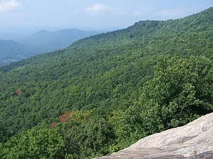
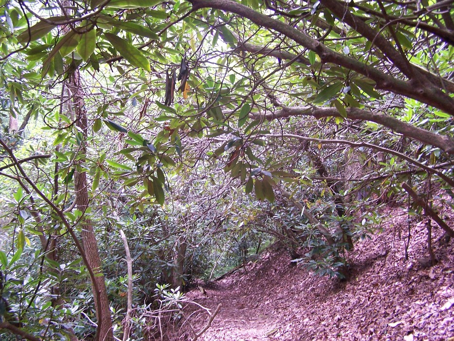
Where rhododendron rule by Crzy4AZ  Driving into and around the park, stop at the scenic overlooks for the characteristic rolling green hills and blue tinged humid thick skies. The area receives 80 inches of rain per year, and shrub tree rhododendron dominate the ground cover thriving in the higher altitude and moist environment. They bloom in late spring to summer and make a mystical dome of interlocking branches above the trails on Black Rock Mountain.
Other trails in the park: 7.2 mi loopJames E. Edmond trail (shares TH with Tennessee Rock trail, combine together for day hike or longer, campsites are here, better valley and lake views) 0.9 mi loopBlack Rock Lake trail 0.3 mi loopAda-hi Falls trail (wooden steps down to an observation deck for the falls) The nearby Dillard House, opened in 1917, is a "don't miss" when you're in the area famous for locally grown produce and homestyle cooking. Check out the Triplog. Leave No Trace and +Add a Triplog after your hike to support this local community. | |||||||||||||||||||||||||||||||||||||||||||||||||||||||||||||||||||||||||||||||||||||||||||


