 Route Editor

| Guide | ♦ | 5 Triplogs | 1 Topic |
details | drive | no permit | forecast | 🔥 route |
stats |
photos | triplogs | topic | location |
| 113 | 5 | 1 |
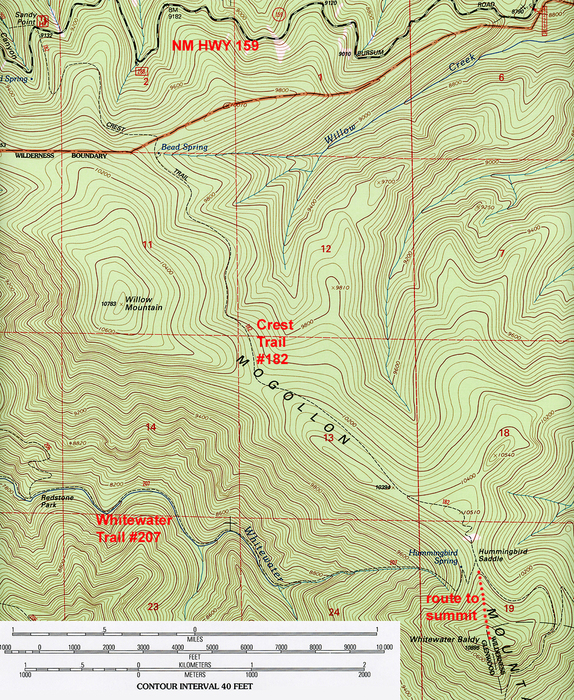
The hike begins at the Sandy Point Trailhead along New Mexico highway 159 (Bursum Road). A sign for the Crest Trail #182 is on the south side of the parking area. The trail heads south and immediately begins a steady climb through cool, dense forest, where mature stands of quaking aspen and moss encrusted engelmann spruce choke out the sunlight along the trail.
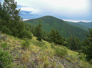
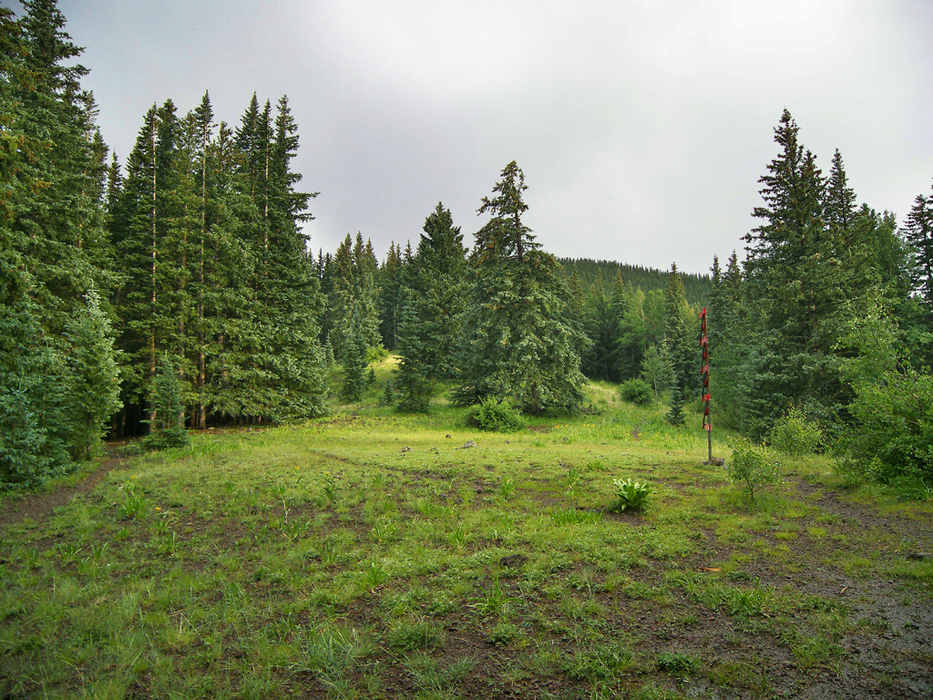
By the four mile point, the trail is well into the 10,000 foot country, and travels along the crest of a broad ridge. Occasional openings in the forest allow for incredible views to the west down Whitewater Canyon. After reaching a high point at 10,510 feet, the Crest Trail makes a short drop down to Hummingbird Saddle at 10,400 feet, where it meets the Whitewater Trail #207. At Hummingbird Saddle the forest opens up to reveal a small idyllic meadow that is perfect for camping. Water should be available at Hummingbird Spring, which is about 0.25 miles down the Whitewater Trail to the west. Again, check with the forest service for current water availability. Leaving the Crest Trail behind, the hike to the peak now heads due south from Hummingbird Saddle up Whitewater Baldy's north ridge. A faint, unsigned use trail marked by occasional cairns leads the way. After a short, steep climb, the use trail arrives in the cool, thin air of Whitewater Baldy's flat, forested summit. A giant rock cairn and a summit register mark the top of the peak. Head a short distance south from the summit to the south edge of the mountain. Here, the trees and mountaintop suddenly give way to fantastic views from Whitewater's bald spot. All points south and west are visible here. Return the way you came, unless you are interested in a longer return hike. There are plenty of options for a long loop hike in this incredible wilderness area.
Check out the Official Route and Triplogs. Leave No Trace and +Add a Triplog after your hike to support this local community. | ||||||||||||||||||||||||||||||||||||||||||||||||||||||||||||||||||||||||||||||||||||||||||||||||||||||||||||


