 Route Editor

| Guide | ♦ | 3 Triplogs | 0 Topics |
details | drive | no permit | forecast | map |
stats |
photos | triplogs | topics | location |
| 30 | 3 | 0 |
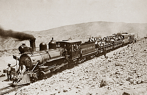
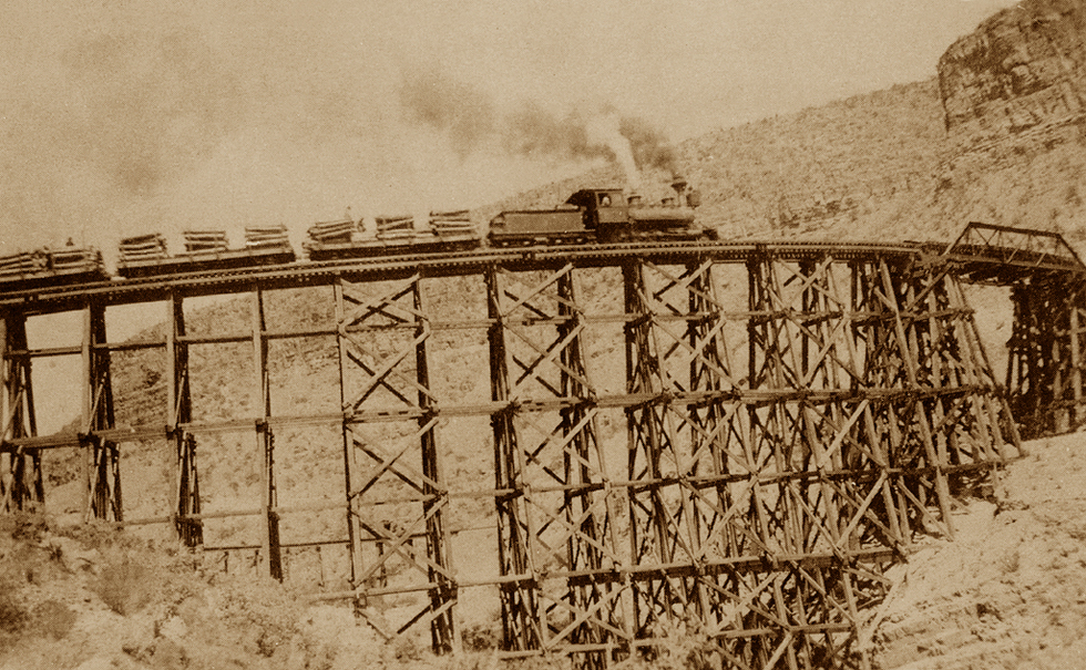
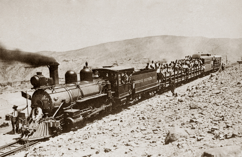
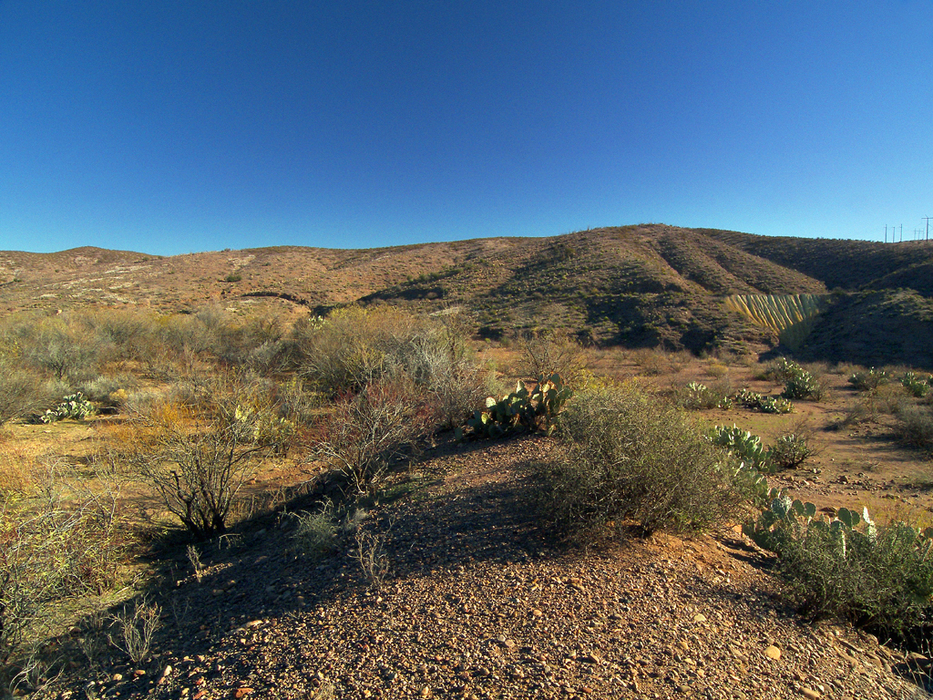
Go prepared! - Caving Checklist copper country corkscrew by PrestonSands  This hike follows a portion of a historic railroad grade, from the San Francisco River to a point just south of modern-day Morenci, Arizona, which was relocated after the original town succumbed to open-pit mining. Interesting features along this hike include a railroad tunnel, relics, and ruins. Mileage for this hike will vary, depending on how much of the railroad grade you end up traveling. This hike follows a portion of a historic railroad grade, from the San Francisco River to a point just south of modern-day Morenci, Arizona, which was relocated after the original town succumbed to open-pit mining. Interesting features along this hike include a railroad tunnel, relics, and ruins. Mileage for this hike will vary, depending on how much of the railroad grade you end up traveling.At the turn of the twentieth century, Phelps-Dodge Mining Company's predecessor, the Detroit Copper Company, needed a more efficient form of transportation for its mines at Morenci. A railroad was the obvious answer, but the landscape it would traverse would be challenging. The Detroit Copper Company chose to construct a narrow-gauge railroad from its mines at Morenci to the town of Guthrie, where it would connect with an existing railroad. A narrow-gauge railroad was better suited for overcoming the topographic obstacles. Three tunnels and five 360 degree loops were necessary to complete the line into Morenci. The little 18-mile line, known as the Morenci Southern Railway, served the area from 1900 until 1922 when it was dismantled.
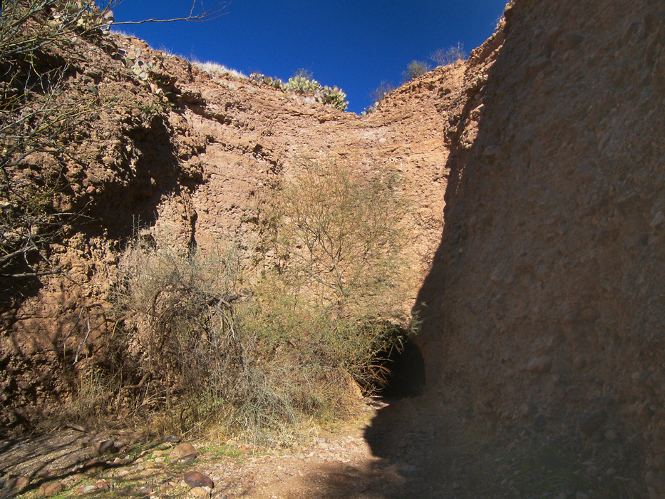
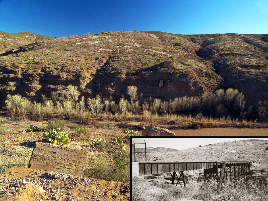
At a flat spot on the road at 0.15 miles, the old railroad grade will be to your left, just below the road. You can start following it downhill here, or continue down the 4 wheel drive road. At around the 0.4-mile point, the railroad grade crosses the road (33.01195 N, 109.31356 W). If you are still on the road, turn right onto the railroad grade, which begins curving east while descending into a small canyon. Where the little canyon comes to an end, it enters a narrow cut in the Gila Conglomerate rock, at the end of which is the railroad tunnel. Proceed into the tunnel. Light from the other portal is not visible until you reach the halfway point of this fully intact, 420-foot railroad tunnel. After exiting the east end of the tunnel, the grade begins descending a hillside overlooking the San Francisco River. At around mile 1.2, the railroad grade arrives on a large bench just above the river. It rejoins the 4 wheel drive road here and seems to disappear. The Morenci Southern made a 180-degree curve next to a corral a few hundred yards to the west, where the grade is still visible as an elevated dirt mound. It then turned south to cross a now-vanished bridge over the San Francisco River. Only the abutments remain, but the grade can be seen ascending the canyon wall across the river. The bench is the former location of a railroad stop known as Frisco. Numerous foundations of crumbling rock can be seen among the mesquite trees on the east end of the bench, near the railroad grade. Whether they are the remains of Frisco or Native American ruins, I do not know. Artifacts of all sorts, ranging from rusted railroad spikes to prehistorically flaked rock, are scattered across the bench. Leave them where you find them. There is access to the San Francisco River on the west end of the bench. However, the cliffs along the south bank will likely prevent access to the southern portion of the Morenci Southern railroad grade. For a faster and more direct return hike, consider taking the 4 wheel drive road back to your vehicle. Check out the Triplogs. Leave No Trace and +Add a Triplog after your hike to support this local community. | |||||||||||||||||||||||||||||||||||||||||||||||||||||||||||||||||||||||||||||||||||||||||


