Route Editor

| Guide | ♦ | 1 Triplog | 0 Topics |
details | drive | no permit | forecast | route |
stats |
photos | triplog | topics | location |
| 10 | 1 | 0 |
O'er the Ramparts we watch'd by chumley From 1948 until 1975, Reynolds' second wife, Eva Dell Reynolds lived on the property and operated it as a working ranch. John died of cancer in 1954, and over time the ranch became too much for Eva Dell Reynolds to manage on her own. On May 28, 1975, JCOS purchased the ranch with Eva Dell Reynolds donating a substantial portion of the land, ranch house, and buildings as a memorial to her husband.
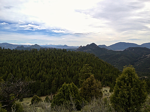
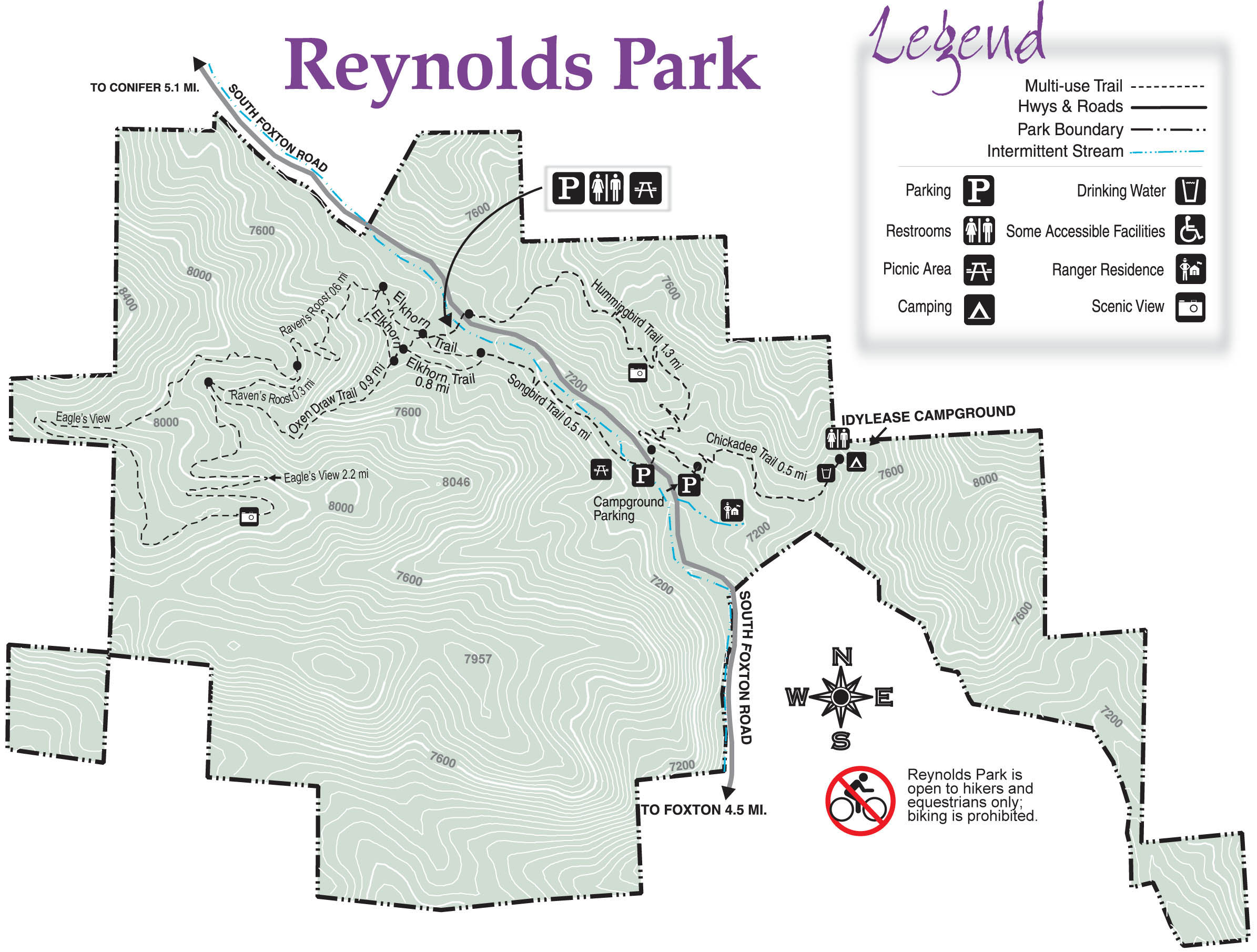
Hike: Reynolds Ranch consists of several short trails that allow visitors to combine routes into a hike that fits their desires. (See official JCOS map). However, the most common and popular hike is described here, leading from the parking area to the viewpoint at Eagle's View, and returning via a gulch along a small stream. Begin by crossing the bridge over Casto Creek and heading to the right on the Elkhorn Trail. After about .3 miles you will encounter the Raven's Roost trail junction where you veer right and continue to climb up hill. At about the 1-mile mark, and after a steady climb, you reach another trail junction. Here again stay to the right, now on the Eagle's View trail. Eagle's View continues to climb along an old roadbed before reaching a small stream crossing (1.75 mi), where it switchbacks and climbs on a more moderate single-track trail. After reaching the top of the hill and turning south, the trail reaches the southern slope, with expansive views of Pike's Peak, the Continental Divide, other small mountain peaks, and the Ramparts to the west (at about 2.3 miles). From the viewpoint, continue on the Eagle's View trail, now heading steadily downhill. At about 3.1 miles, the trail reaches a draw and another trail junction. Again, stay to the right, now following the Oxen Draw Trail, which follows the creek drainage down toward the parking area. Near the bottom of the draw, pass the first trail junction with the Elkhorn trail but a hundred yards farther, turn right on Elkhorn. Follow it for .25 miles before it reaches the junction with the Songbird Trail. Turn left here, entering the meadow and returning to the bridge across Castro Creek back to the trailhead. Notes: Reynolds Park trails are open to hiking and equestrian use only. A new mountain biking trail is scheduled to open in late 2013. Camping is not permitted outside of the developed campground. Check with the JCOS website for more details and information.
Check out the Official Route and Triplog. Leave No Trace and +Add a Triplog after your hike to support this local community. | |||||||||||||||||||||||||||||||||||||||||||||||||||||||||||||||||||||||||||||||||||||