 Route Editor

| Guide | ♦ | 4 Triplogs | 0 Topics |
details | drive | no permit | forecast | 🔥 route |
stats |
photos | triplogs | topics | location |
| 17 | 4 | 0 |
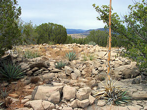
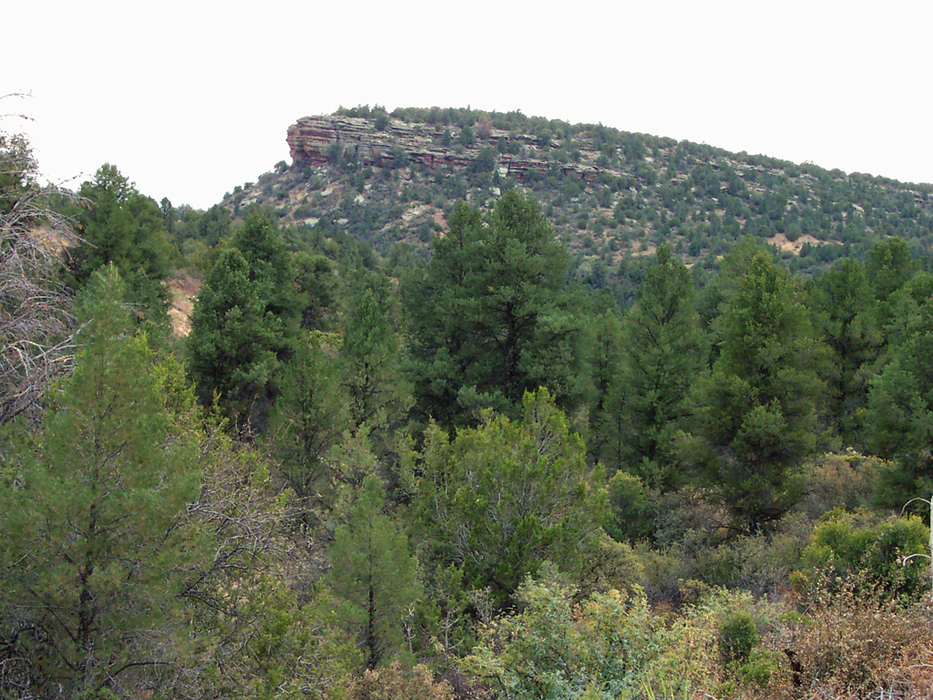
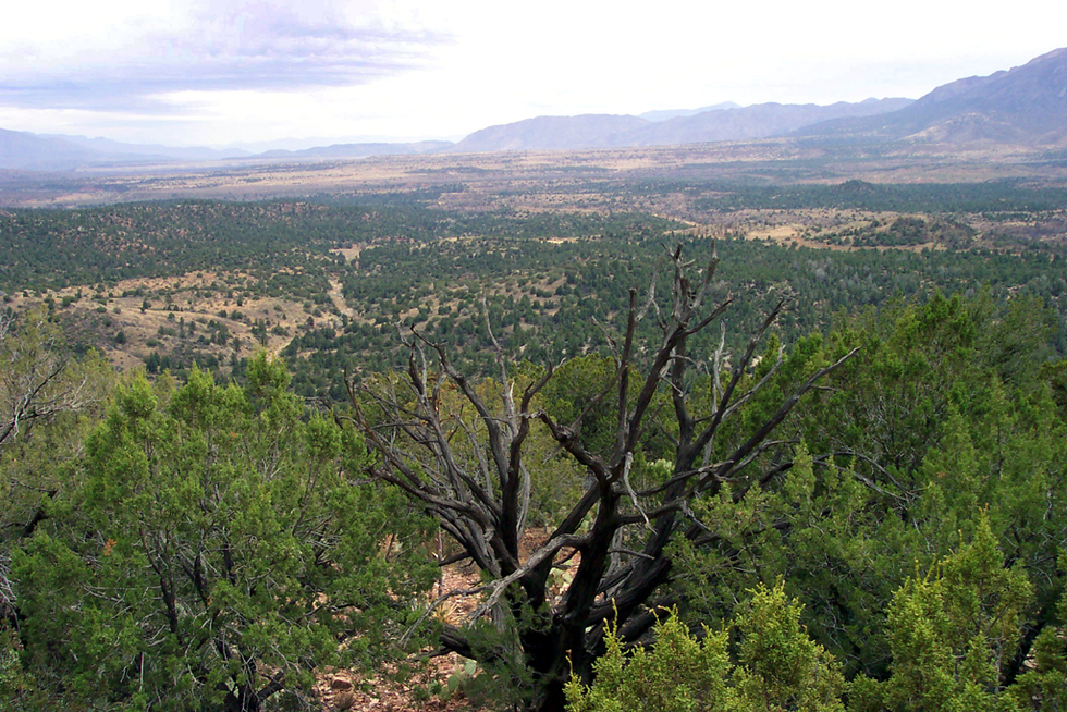
Paleo watchtower in a sea of cypress by PrestonSands   Overview OverviewTable Mountain is a small, rocky mesa that rises above Cypress Thicket, on the east side of the Mazatzal Mountains. Crowning its cliff-edged summit is a crumbled, circular ruin, somewhat similar to (but much less impressive than) Circlestone. Views from the summit are impressive for this little peak. Table Mountain is unusual geologically, as it consists of an isolated patch of Paleozoic sedimentary rock in the middle of Cypress Thicket's Tertiary sediments. No trail leads to the summit, but the saddle on the west side of Table Mountain, along forest road 193, makes a good place to start. Warning Roads in Cypress Thicket can be extremely muddy (and impassable) after prolonged periods of wet weather!
Where forest road 193 crosses a cattle guard at the saddle, there is a dirt parking area that makes a good place to park. From here, a short side road takes off towards Table Mountain, heading southeast. It comes to an end at the base of the mountain after a few hundred yards. At this point, start hiking up the mountainside through the pinyons, and over the many purplish terraces of Tapeats sandstone. There is nothing difficult here, as it's only a few hundred feet of elevation gain, through fairly open terrain. Once you reach the top, the rock changes to the dense, chalky-colored limestone of the Martin Formation. Head northeast through the junipers along the mountain top, to the true summit at the northeast corner of the mountain. When you reach the summit, head a few hundred feet to the north along the mountaintop to reach the ruin. It is about 30 feet in diameter, circular, and constructed of the mountain's pale limestone. The large number of rocks which compose the ruin seems to indicate that it once had sizable, upright walls. The walls, however, have completely collapsed, and the ruin may not be immediately recognizable. Be sure to wander over to the cliffs on the mountain's edge. There are nice views in all directions, depending on where you are at. The Rim, the Mazatzals, and Tonto Basin are all visible. For the return trip, retrace your steps, as all sides but the west are cliffs. Locate, then head towards your vehicle, which should be visible from the mountaintop. Check out the Official Route and Triplogs. Leave No Trace and +Add a Triplog after your hike to support this local community. | |||||||||||||||||||||||||||||||||||||||||||||||||||||||||||||||||||||||||||||||||||||||||||||||||||||||||||


