 Route Editor

| Guide | ♦ | 18 Triplogs | 0 Topics |
details | drive | no permit | forecast | 🔥 route |
stats |
photos | triplogs | topics | location |
| 246 | 18 | 0 |
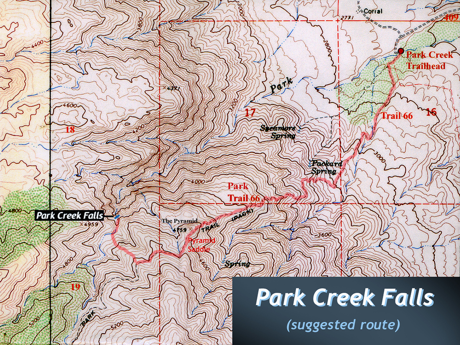
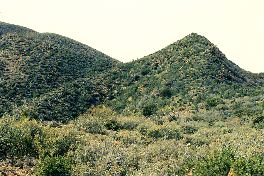
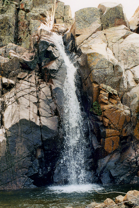
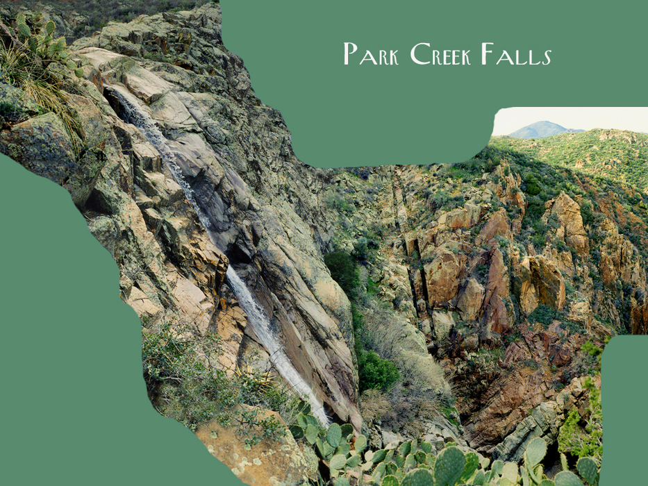
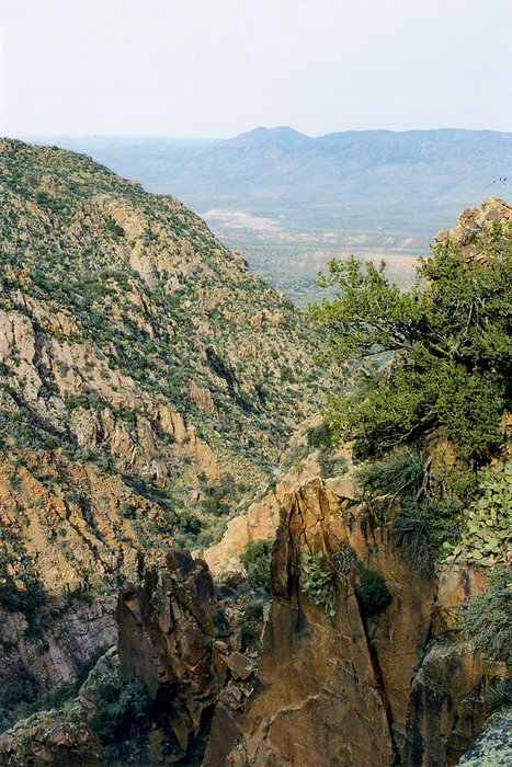
acrophobia nightmare by PrestonSands   Overview OverviewWell hidden in central Arizona's Mazatzal Mountains is Park Creek Falls, one of many large, seasonal waterfalls in this rugged range. Park Creek Falls is located where Park Creek suddenly drops off the top of the range, below Edwards Park. There are two waterfalls here: a 30-foot upper falls and the 100 to 160 foot lower (main) falls. The height of the lower falls is a guess, based on the U.S.G.S. topo map and my observations. The falls can be reached by a short, off-trail hike, starting from either Park Trail #66, or forest road #422 (El Oso Road). This description begins on the Park Trail. The best time to see the falls is after wet winter weather or snowmelt. If Park Creek has a healthy flow at the trailhead, Park Creek Falls should, too.
Warning This hike consists of both on and off-trail hiking through rough country, that was severely burned during the 2005 Edge Complex wildfire. The Park Trail, which this hike begins on, receives little or no maintenance, so following it may be difficult. Boulders and dead trees cling precariously to the area's steep terrain, just waiting to injure unsuspecting hikers who may come into contact with them. Footing near the edge of the lower falls is sketchy, and a fall there would likely result in death. Be very careful when hiking in this rugged area! Hike Beginning at the Park Creek Trailhead, start hiking up Park Trail #66. After ascending a low ridge at the foot of the Mazatzals, the Park Trail starts a steady climb up the eastern wall of the range. Sweeping views of Tonto Basin and central Arizona motivate to continue the ascent. After a 2000 foot climb in a little over 2 miles, the trail reaches a cone-shaped hill I call "The Pyramid" (peak 4759). The Park Trail passes through Pyramid Saddle on the south side of the Pyramid, then begins to level out. Once you are above the 4800-foot contour, and about 0.25 to 0.5 miles past Pyramid Saddle, pick a ridge or ravine below the Park Trail, and head for the bottom of Park Creek. When you reach Park Creek, begin heading downstream (north). The creek reaches the upper falls at about the 4400 foot contour. Down climbing along the east side of this waterfall provided me with a do-able route. From the upper falls, it is a short walk down the bouldered creek bed to the lower (main) falls. As the creek crosses the bedrock shelf at the top of Park Creek Falls, it enters a chute carved into the pale granite by countless years of runoff. Park Creek Falls does not make a vertical drop, but rather cascades over a 60 degree granite wall. The falls disappear into a maze of polished monoliths at the base of the cliff. It is so rugged here that one cannot see the bottom of the gorge. For a better vantage point, carefully work your way north from the top of the falls, along the east canyon wall, until you cliff out. At this point, you should be able to see most of Park Creek Falls. Be extremely careful where you step, so as not to slip into the abyss. In the distance, Park Creek can be seen entering a narrow gorge with smaller waterfalls, before curving east to enter Tonto Basin. The top of Park Creek Falls is the end of the line for this hike unless you are a climber (or crazy!) Return the way you came.
Check out the Official Route and Triplogs. Leave No Trace and +Add a Triplog after your hike to support this local community. | |||||||||||||||||||||||||||||||||||||||||||||||||||||||||||||||||||||||||||||||||||||||||||||||||||||||||||


