Overview
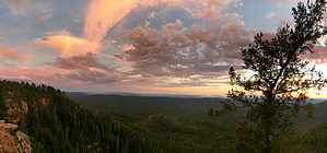
Gila county high point sits 525 NE of Promontory Butte 7,914. The 15 Arizona highpoints is a popular list to tackle. Gila County is south off the edge of the rim. The hike & 7,914 are Coconino County. The highpoint for Coconino is Humphreys Peak North of Flagstaff.
Hike
Arbitrary as a standalone hike. The Official Route here is just a nice option. Most of which follow old faded forest roads.
WARNING! Hiking and outdoor related sports can be dangerous. Be responsible and prepare for the trip. Study the area you are entering and plan accordingly. Dress for the current and unexpected weather changes. Take plenty of water. Never go alone. Make an itinerary with your plan(s), route(s), destination(s) and expected return time. Give your itinerary to trusted family and/or friends.
Permit $$
None
Directions
Road
High Clearance possible when dry
To hike From the major intersection 87/260 in Payson 43.8 mi. About 1 hour 4 mins
1. Head east on AZ-260 E toward S Goodnow Rd 29.2 mi
2. Turn left onto Rim Rd 9.4 mi
3. Turn left to stay on Rim Rd 3.0 mi
4. Turn left onto Forest Service Rd 764 2.2 mi
 Route Editor

 Overview