Overview
Looking for a good walk in the White Tank Mountains? Sick of the crowds that the Waterfall Trail brings? Don't feel like heading miles into the mountains? If you answered yes to any of these questions, you may want to give Mule Deer a shot.
What separates this trail from the other low-lying trails in the park is that it doesn't parallel a road, and that's one noise avoided. While the trail does cross the park's main road at one point, the majority of it is away from the hustle and bustle of waterfall traffic.
Hike
Beginning at the north end of the trail, you'll do a bit of an unnecessary b-line and then pass a spur trail heading to Area 4's group picnic area. This is where much of the climbing is done. It's a measly and gradual 96ft that leads around a small hill. Soon after, you'll meet up with the Bajada Trail.
Should you choose to continue along Mule Deer, you'll pass along some horse stables on your left (east). The rest of the trail is a gentle meander at the foot of the White Tank Mountains. After crossing the main road, you'll wrap around and meet up with the South Trail. Return the 3.3 miles you came, or begin the rest of your loop, whatever that may be - there are plenty of options.
Note
Just before crossing the main road, there is a spur trail heading to the Nature Center (it's well signed - you can't miss it). This might be a worthwhile side-trip if you have kids or just want to pay a visit and see some interesting stuff.
When hiking several trails on a single "hike", log it with a generic name that describes the hike. Then link the trails traveled, check out the example.
WARNING! Hiking and outdoor related sports can be dangerous. Be responsible and prepare for the trip. Study the area you are entering and plan accordingly. Dress for the current and unexpected weather changes. Take plenty of water. Never go alone. Make an itinerary with your plan(s), route(s), destination(s) and expected return time. Give your itinerary to trusted family and/or friends.
To hike Take the I-10 west out of Phoenix to the 101 Loop Freeway. Go north on the 101 to Olive Blvd. Take a left and head west 13.5 miles to the White Tank Mountain Park entrance. Continue into the park on White Tank Mountain Road. Follow the main road for about 2.1 miles and turn right onto Wildlife Way (if you hit Waterfall Canyon Rd, you just missed it). Follow the road to a lone tree on the right (the road circles it). The trail begins on the south side of a tree.
doug h adds... With the growth in the west valley, a faster way to get to the White Tank Mountain Park from downtown (PHX) is to stay on I-10 to Cotton Lane. Then go North 7 miles to Olive Ave., there is a stop sign and a Fertazone plant on the NW corner. Take a left (west) to the park. By going this you miss the new stoplights and the added stop signs on Olive. This is only a suggestion, I know the parks department has you going out Olive from the 101 loop.
 Route Editor

 Overview
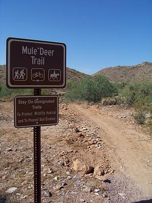


