 Route Editor

| Guide | ♦ | 32 Triplogs | 0 Topics |
details | drive | permit | forecast | route |
stats |
photos | triplogs | topics | location |
| 166 | 32 | 0 |
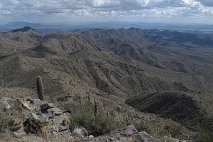
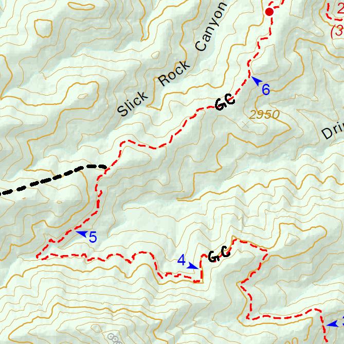
Not as Breathtaking, Literally by PatrickL  Barry Goldwater Peak (4083), named after the Arizona-born US Senator, is the White Tank Mountain Range's high point. Most views attribute that title to the popular Radio Summit which is just 65ft shy of BG Peak. The summit isn't visited by hikers all that often. It offers views of some western peaks that Phoenix locals probably don't get to see that often. Barry Goldwater Peak (4083), named after the Arizona-born US Senator, is the White Tank Mountain Range's high point. Most views attribute that title to the popular Radio Summit which is just 65ft shy of BG Peak. The summit isn't visited by hikers all that often. It offers views of some western peaks that Phoenix locals probably don't get to see that often.Hike: This is an easier, less rugged approach to Barry Goldwater Peak, starting at the Area #7 trailhead. The majority of the rocky terrain is seen in the first 1.7-mile section and isn't all that bad. From here, the trail forks, and you'll want to head left. The rest of the MQ trail is a gradual climb on reasonably level terrain. After mile marker 4, you'll begin to wind up and around an unnamed peak (3032). At the next junction, hop onto the Goat Camp Trail.
For an extra 1.8 miles, start at the true Mesquite Canyon TH on Wildlife Way. I recommend taking the Ford Canyon/Willow Canyon trails on your way back down. According to the new park maps, it's 0.1 miles shorter than the 2.4-mile section of the Mesquite Trail, so there's no excuse not to. Make sure to edit your triplog information accor0dingly. Check out the Official Route and Triplogs. Leave No Trace and +Add a Triplog after your hike to support this local community. | ||||||||||||||||||||||||||||||||||||||||||||||||||||||||||||||||||||||||||||||||||||||||||||||||||||||||||||||||||||||||||||||||||||||||||||||||||||||||||||||||||||||||||||||||


