 Route Editor

| Guide | ♦ | 3 Triplogs | 0 Topics |
details | drive | no permit | forecast | route |
stats |
photos | triplogs | topics | location |
| 44 | 3 | 0 |
Tropical Rum Punch! by chumley In 1933, under FDR, Congress enacted the Federal Emergency Conservation Program which spawned the Civilian Conservation Corps (CCC). Under the supervision of the Forest Service, CCC recruits from the island began working on projects in the forest such as "Building a road through the cliffs and jungles of the Luquillo Mountains", reforestation, and construction of recreational facilities. Altogether, the CCC program in Puerto Rico employed 2,600 local laborers, many of whom performed work on the island's forests. Many of the forest's roads and facilities that were built during the CCC years (1935-1943) are still very much in use, a lasting tribute to the island's "tres C's" (CCC) workmen who labored under extremely difficult conditions, using only the tools and equipment they could carry on their backs, to construct trails and roads through the forest.
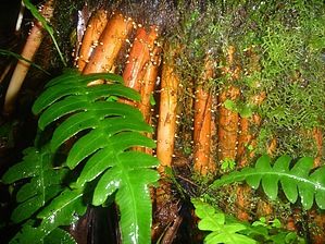
Trail Description The trail starts across the street from the Palo Colorado visitor center, heading uphill parallel to a nice cascading stream. About 100 yards uphill the trail turns right and heads away from the Bano Grande, an old recreational pool no longer open for swimming. After swinging around the mountain, the trail forks, and the El Yunque Trail heads uphill to the left. From here, there's no problems with route finding for quite a while. The hike proceeds steadily uphill, but not arduously. Some of the trail is on crushed flagstone, other parts are more rocky. Rarely there is a wet puddle or muddy section that is challenging to navigate. There are nearly constant water drainage structures on the trail that require attention to footing. As you proceed uphill, you will encounter several mountain creeks and small cascades. Abundant tropical flora can be seen in every direction, dominated by the Mountain Sierra Palm Tree and it's impressive and colorful buttress roots. Another dominant species is the enormous fallen leaves of the Yagrumo Hembra tree, which approach 2-feet in diameter. As you hike, the chirping of the native coqui treefrog is easily discernible, though I was not ever able to spot one. Their chirp silences when you approach, and since they are only about 1/2-inch in size, they are very difficult to spot. Also worth looking for is the elusive Puerto Rican Parrot, a bright green parrot about a foot tall. Since everything else here is bright green, it is also very difficult to spot! Since this is a rainforest, and can receive over 200 inches of rain annually, you are likely to encounter it on your hike. The temperatures remain fairly constant year-round, and the diurnal shift is minimal due to the extreme humidity. A range of the upper 60s to low 80s is typical anytime you're here. As a result of the rain, there are numerous covered shelters constructed by the CCC in the 1930s where you may take a break during a brief rain shower. The last of these is a more significant stone structure that includes an old chimney located at the junction of the Mt. Britton Spur Trail at about the 1.35 miles. From this point there are no further shelters until reaching the peak, where there is a small stone tower. At 1.9 miles, the trail forks again, with the right fork being the Los Picachos Trail, and the left fork continuing uphill toward the peak. As you approach the peak, you will hear the sound of a diesel generator which powers the communications towers on the peak, and upon reaching the paved road (closed), turn left and make the short climb to the tower. I've read that reaching the peak before noon results in greater chances of open views of the forest below and to the sea to the north and east of the island. Apparently the clouds are more likely in the afternoon and visibility is obscured, as was the case for me. From the peak, you may return the way you came, or you may return partially to the Mt. Britton Spur and visit the Lookout at Mt. Britton on the way down. Before heading back down however, I would recommend taking the very short hike from just below the peak out to "La Roca", which traverses the very unique flora of the "Dwarf Forest" that only exists on the highest exposed peaks of the rainforest. Its worth the extra 15 minutes! The La Roca Trail is marked on the signs and begins from behind the fence line of one of the communications towers. Warning Its a RAIN forest. It WILL RAIN. It IS WET. ALL the time. You will be wet. Your stuff will get wet. Be prepared. Plan ahead. If you feel comfortable hiking in Teva's, they are an option, though this is a fairly strenuous trail as far as footing goes. This trail is well maintained, and properly drained, so it is unlikely that you will ever have to step in any water or mud if you are paying attention. I wore a pair of Merrill Moab Ventilators, and my feet never got wet, despite enduring several downpours and not a single dry-surfaced step all day. Camping As a note, camping is allowed throughout the El Yunque National Forest. However it is required to obtain a free permit from the FS. There are no developed campsites, and it will be a wet experience for you! It's a great place for all you "hangers" who like to hover above the surface and there are plenty of trees and a lack of flat ground! There are no poisonous snakes, and no predators (at least not for you), so an overnight might be a great way to maximize your experience. Just be prepared to keep you and your stuff dry! There is a gate along the road that closes at 6pm daily, so you must be out of the forest by that time or else you may be forced to be camping! There are ample signs warning you of this. Gate Policy: If a gate is closed upon arrival, leave it closed after you go through. If it is open, leave it open. Leaving a closed gate open may put cattle in danger. Closing an open gate may cut them off from water. Please be respectful, leave gates as found. The exception is signage on the gate directing you otherwise. Check out the Official Route and Triplogs. Leave No Trace and +Add a Triplog after your hike to support this local community. One-Way Notice This hike is listed as One-Way. When hiking several trails on a single "hike", log it with a generic name that describes the hike. Then link the trails traveled, check out the example. | ||||||||||||||||||||||||||||||||||||||||||||||||||||||||||||||||||||||||||||||||||||||||


