Route Editor

| Guide | ♦ | 30 Triplogs | 0 Topics |
details | drive | no permit | forecast | map |
stats |
photos | triplogs | topics | location |
| 412 | 30 | 0 |
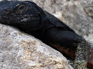
Solid off-trail exploring by airic  I continually come back to the Eagletails, but not once have stuck to the Ben Avery Trail. It is always an off-trail day and doesn't properly fit under the Indian Springs Trail log as only now and then do I pass the petroglyphs. This has led me to create a guide, so I can log it and share it with you. Since I never do the same hike twice here, I call it a day wandering in the Eagletails... so we now have the Eagletail Mountains Wander. If you need a map, take a look at the Indian Springs description as everything I say below is just off memory. I continually come back to the Eagletails, but not once have stuck to the Ben Avery Trail. It is always an off-trail day and doesn't properly fit under the Indian Springs Trail log as only now and then do I pass the petroglyphs. This has led me to create a guide, so I can log it and share it with you. Since I never do the same hike twice here, I call it a day wandering in the Eagletails... so we now have the Eagletail Mountains Wander. If you need a map, take a look at the Indian Springs description as everything I say below is just off memory.For anyone new to hiking off-trail, I highly recommend this location. It is easily accessible, has an easy entrance trail, and has numerous recognizable peaks to help you keep your bearings. Oh, not to mention the Eagletails are excellent for wildlife viewing... I am a little biased as well, as this is the only place I've seen a cougar. Other perks include extremely cool ridges and mountain tops to hike with an uncountable number of grottos and alcoves to shelter animals... and you for a night in the desert. If you're a plant-person, this is one of the nicest pieces of Sonoran desert I've hiked. And of course, there is cultural history here ranging from prehistoric to mining activity. Basically, this is an incredible spot to explore the Sonoran desert.
I start us at the Ben Avery Trailhead, take you into what I call the Bowl, and then leave you to your devices from there. From the TH, follow the old jeep road into a reasonably sandy wash. Take a right, SW, if I remember correctly. This wash will eventually get you back to the old jeep road, a mile maybe from the TH. The wash is typically flagged at bends to lead you to the old jeep road. It's easy. As you come out of the wash, you enter the Bowl. I name it this because, well, it feels a little bowl-like. As you scan your horizons, you'll see that you're pretty much penned in by mountain ridges all around. Ok, turn around and look at Courthouse Rock. This is the feature you parked your car at, lock it in. This is now your point of reference and can be seen from quite a distance. Also, look to the east, and you'll see a few namesakes of these mountains... eagletails. Ah, pretty cool. It makes you wish you had some climbing gear. We'll stay on the trail slightly longer, and then you're loosed. Carry on until you hit a big, sandy wash again. This is roughly an hour in and has been an easy hike. Now, look on the horizon for what looks like the coolest ridge and tackle it...that's it. To the left, in the wash, you'll find the petroglyphs another 15 minutes up; and any other humans out here. Behind you is what I call Cougar Ridge, as that is where I spotted a cougar. Beyond the ridge are a few eagletails and some mine shafts. Northwest of you is Neon Top (my name). It is the light brown, bald looking peak and covered in green lichen up top. En route, you may pass, or see, a large alcove... it's been used as a vulture roost in the past. If you stick to the jeep road across the wash, you'll shortly come on an AGFD stock tank, Dead Deer Tank (real name). Follow the game trails beyond the tank towards Two-Holes (you may have noticed this to the west as you hiked across the Bowl, at least from a distance, you can see one hole clearly). Plod in, around, and over arroyo after arroyo to a real nice and rugged area. Pop-out of the Bowl and climb those rocks... a passable route always appears. I don't know, explore anywhere. The ridges out in this range are fantastic. Bring a map in case you are not familiar with off-trail. But, as you'll see out here, the horizon offers many distinguishable shapes to use as a bearing. So, let your adventure unfold and go wherever the terrain, an animal, or thought leads you. Well, that's the hike, more or less. I've spent 3 hours here... I've spent 10 hours. It's all up to the hiker really and how many ridges you want to climb. This is a sweet spot, and I always have great success in finding something neat. If you get off-trail, you're going to see more animals. Have fun, and don't tell too many friends as I have enjoyed not seeing humans out here! Refer to Indian Springs Petroglyphs for the Ben Avery Trail section. BLM Division Details Location and Description The 100,600-acre Eagletail Mountains Wilderness is about 65 miles west of Phoenix, Arizona, in Maricopa, Yuma, and LaPaz counties. The wilderness includes 15 miles of the Eagletail Mountains ridgeline and Courthouse Rock to the north, Cemetary Ridge to the south, and a large desert plain area between the two ridgelines. Several different rock strata are visible in most places, with natural arches, high spires, monoliths, jagged sawtooth ridges and numerous washes six to eight miles long. Recreation such as extended horseback riding and backpacking trips, sightseeing, photography, rock climbing and day hiking are enhanced by the topographic diversity, scenic character, size, as well as the botanical, wildlife, and cultural values of the area. Access From Phoenix, travel west along Interstate 10 to the Tonopah exit. Travel south from Tonopah to the paved Salome Highway, then west to the Harquahala Valley via the Courthouse Rock Road. Roads near the wilderness include the pipeline maintenance road on the north and East Clanton Well Road on the south. High-clearance or four-wheel-drive vehicles are needed for access to the wilderness boundary. Nonfederal Lands Some lands around and within the wilderness are not federally administered. Please respect the property rights of the owners and do not cross or use these lands without their permission. As with other types of outdoor activities, wilderness travel poses some potential hazards. You may encounter flashfloods, poisonous snakes and insects, poisonous plants, or lightning storms. Be aware of your exposure to heat or cold. Don't panic if you get lost. Carry an ample supply of water with you since many areas may have inadequate or contaminated water sources. Check out the Triplogs. Leave No Trace and +Add a Triplog after your hike to support this local community. | |||||||||||||||||||||||||||||||||||||||||||||||||||||||||||||||||||||||||||||||||||||||||||||||||||||||||||||||||||||||||||||||||||||||||||||||||||||||||||||||||||||||||||||||||||||||||||