username
X
password
register
for free!
help
 This is likely a great time to hike this trail!  Check out "Preferred" months below, keep in mind this is an estimate.
  🔥

Conner Canyon, AZ

Guide 5 Triplogs  0 Topics
  4 of 5  
Fav
Wish
1
details
drive
no permit
forecast
🔥
route  
stats
photos
triplogs
topics
location
31 5 0
Canyons are inherently risky. Flash floods occur without notice on sunny days. Technical skills & surrounding topography knowledge required yet does not eliminate risk.
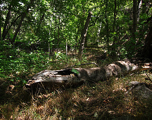
Statistics
tap row or icons for details
Difficulty 3 of 5
Distance One Way 1.55 miles
Trailhead Elevation 5,533 feet
Elevation Gain -929 feet
Accumulated Gain 3 feet
Kokopelli Seeds 1.56
 Interest Off-Trail Hiking, Historic & Perennial Creek
feature photo
Photos Viewed All MineFollowing
Inaugural Calculation on Button Tap!
39  2025-05-31
Sierra Ancha FR 2325 & 142
CannondaleKid
11  2021-11-18 eru
25  2018-01-30
Conner Canyon Ruins - Sierra Ancha
Grasshopper
5  2011-09-03 ssk44
15  2010-10-02 ssk44
Author
author avatar Guides 8
Routes 10
Photos 1,028
Trips 40 map ( 108 miles )
Age 44 Male Gender
Location nomadic
Co-Author
co-author avatarGuides 20
Routes 12
Photos 2,343
Trips 298 map (840 Miles)
Age 51 Male Gender
Location Gilbert, AZ
Historical Weather
Trailhead Forecast
Radar Map
Expand Map
Preferred Jul, Aug, Sep, Oct → 7 AM
Sun  6:00am - 6:46pm
Official Route
 
0 Alternative
 
Historic Fire Perimeteracres
🔥 1994 Armer Fire5.7k


Reprogrammed T-800
by eru & ssk44

 Likely In-Season!
2010 ssk44
The perennial segment of upper Conner Canyon, located in the backdrop of Armer Mountain.


2021 eru
There's a large pullout with an empty covered signage board below the trail - there's a path leading directly from it south that just heads up to a nearby hill with no real view, head up 288 a couple hundred feet and there's an obvious 4WD/ATV road to follow down. It has enough growth along the sides to provide some shade in the morning and evening. It's a fairly moderate grade and seems to get far more wheeled use than booted.
remove free decal offer
Once down in the canyon following the creek was surprisingly easy - very little spiky/poky plants and while being very lush it's not overgrown. Water levels were low enough we were boots dry in the creek itself but would hop out of it occasionally and never had any issues with a bypass. There are some fallen small shelters near where the 4WD road meets the creek along with some scattered trash, but it feels very pristine below that.

Didn't encounter anything I'd consider canyoneering, but we didn't explore the full canyon. The route will get you down there. :)

2021-11-22 eru & ssk44


    Check out the Official Route and Triplogs.
    Leave No Trace and +Add a Triplog after your canyon trip to support this local community.
    WARNING! Hiking and outdoor related sports can be dangerous. Be responsible and prepare for the trip. Study the area you are entering and plan accordingly. Dress for the current and unexpected weather changes. Take plenty of water. Never go alone. Make an itinerary with your plan(s), route(s), destination(s) and expected return time. Give your itinerary to trusted family and/or friends.

     Permit $$
    None


     Directions
    or
     Road
    Paved - Car Okay

    To canyon trip
    Globe - Highway 88 - Highway 288 - TH (Lat. 33 Degrees/47'/53.76"/N & Long. 110 Degrees/59'/01.00"/W)
    page created by ssk44 on Oct 02 2010 5:08 pm
     90+° 8am - 6pm kills
    helpcorrectionissue

    end of page marker