Route Editor

| Guide | ♦ | 22 Triplogs | 3 Topics |
details | drive | no permit | forecast | route |
stats |
photos | triplogs | topics | location |
| 70 | 22 | 3 |
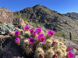
New trails in South Mtn! by Moovyoaz  In 2009, the city of Phoenix paid $18 million for 240 acres of state land in the foothills northwest of Ahwatukee known as the South Mountain 620, to eventually be added into South Mountain Park. In April 2010 several yet-to-be-named trails were constructed by volunteers that connect to existing South Mountain Park's trails and open up the southwest corner of the park to hikers and mountain bikers. The trail names below are not official but are commonly used by hikers and bikers who frequent these trails. The city will name the trails on future maps, and this description may be updated at that time. In 2009, the city of Phoenix paid $18 million for 240 acres of state land in the foothills northwest of Ahwatukee known as the South Mountain 620, to eventually be added into South Mountain Park. In April 2010 several yet-to-be-named trails were constructed by volunteers that connect to existing South Mountain Park's trails and open up the southwest corner of the park to hikers and mountain bikers. The trail names below are not official but are commonly used by hikers and bikers who frequent these trails. The city will name the trails on future maps, and this description may be updated at that time.In October 2010 I led a group of hikers starting from the western end of the park, at a parking area off Dusty Lane. Please be considerate when parking in this neighborhood. This is unofficial access into the park suggested to me by a park ranger, since the western end of San Juan Road was closed inside the park. Note these trails can also be accessed from the 17th Ave and Thunderhill Drive trailhead.
Once on the National Trail, we continued east, climbing this seldom-used section of the trail. If you're tired of the crowds on the eastern end of the National Trail, give the western end a try, and leave the hordes behind. Just past TP 42, the new Kebo heads south for 0.3 miles, a steep descent to the new Valley View Trail. At this junction we again turned east, paralleling the National Trail above and our return trail to the south. The trail begins a gradual ascent of 350 ft, then drops 500 ft down to trails that lead to the mysterious Lost Camp ruins (see the HikeAz writeup), as well as a couple of steep trails back up the National Trail, which we left for another day. At the junction with the Gila View Trail, we started our loop back west. This trail is the steepest part of the loop, climbing 600 ft, and then drops back down into the secluded valley we passed on our journey east. After about 2.5 miles, the trail follows an old jeep road for 0.2 miles, then turns northwest for 0.7 miles, climbing back to the old mine road we started on near the National Trail TP 45. It's another 1.3 miles back to the starting parking area. The total distance was about 9 miles, not including a side jaunt to the Lost Camp ruins. Check out the Official Route and Triplogs. Leave No Trace and +Add a Triplog after your hike to support this local community. | ||||||||||||||||||||||||||||||||||||||||||||||||||||||||||||||||||||||||||||||||||||||||||||||||||||||||||||||||||||||||||||||||||||||||||||||||||||||||||||||||||||||||||||||||||||||||||||