 Route Editor

| Guide | ♦ | 29 Triplogs | 0 Topics |
details | drive | no permit | forecast | 🔥 route |
stats |
photos | triplogs | topics | location |
| 530 | 29 | 0 |
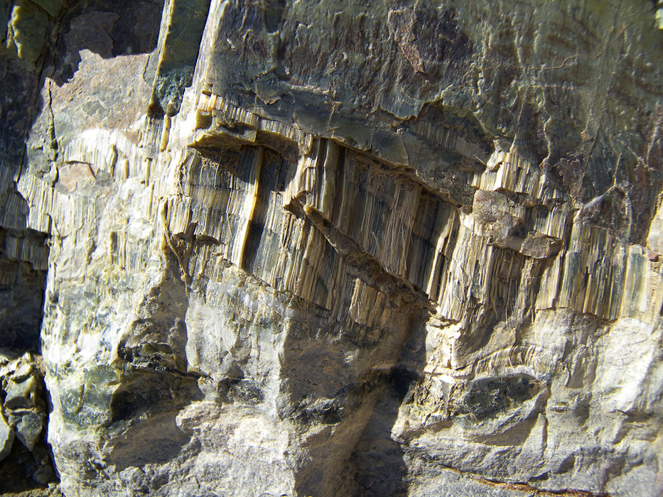
DO hold your breath by PrestonSands   Overview OverviewThis hike to Asbestos Point, a peak on the southern edge of the Sierra Ancha, climbs the Pocket Creek drainage, following the steep and rough route of Forest Road 489. Those who frequent the Sierra Ancha will recognize Asbestos Point by its white mine tailings, which are visible from Highway 288. The hike is well shaded by pine forest, and the view from Asbestos Point is outstanding. Abandoned asbestos mines below the summit make for an interesting side excursion. Getting to the mountain overlook at the end of Forest Road 489 is easy enough, but locating the jeep trail up to the summit of Asbestos Point itself will take some work. Be patient and bring a map or GPS. History/Geology Mining on Asbestos Point began around 1915, when serpentine or "chrysotile" asbestos was discovered in the Precambrian Mescal Limestone. The asbestos was formed by contact metamorphism, where a diabase sill (magma) intruded the Mescal Limestone.
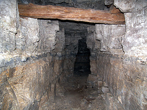
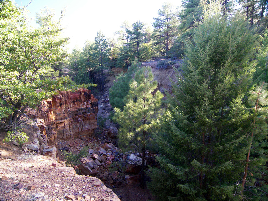
While I don't recommend entering the asbestos mines, if you do, try to avoid stirring up or breathing any dust. Hike The hike begins where Forest Road 489 leaves the east side of Highway 288, at milepost 277.1. There is limited parking available along the highway here and near the beginning of Forest Road 489. Start hiking east on Forest Road 489 (which should be signed) up Pocket Creek canyon. The rough road soon passes a small campsite and some old concrete foundations. Oaks and sycamores eventually give way to ponderosa pines, Douglas firs, and maples, as the canyon closes in on the increasingly rough road. One mile in, the road passes a small green shack at a spring. Across the road from it is a thirty-foot seasonal waterfall in a side canyon. The road forks around 1.3 miles, stay right (uphill). The rest of the hike up Pocket Creek is a straightforward road hike, and elevation is gained quickly along its steep route. As the road nears the top of Pocket Creek canyon, it levels out a bit and passes a rusty old stove near some old rock foundations. A spur road climbs the hill to the right here, but continue going straight. FR 489 soon switchbacks to the right and climbs a bit more to a flat, open area in a broad saddle overlooking Roosevelt Lake. A confusing network of roads branch off from the saddle. The one to the left follows the mountain top towards Zimmerman Point, before coming to a dead end. Two roads fork to the right at the saddle. The left fork enters a road cut and drops off the top of the mountain to the asbestos mines, coming to an end in a half-mile. There are several mine tunnels that one can enter and explore along the way. The right fork is a jeep trail (ATV really) that quickly comes to the east side of an open mine trench. This jeep trail crosses the trench on its north side, then u-turns south to climb along the west side of the trench. Following this jeep trail to the summit is far easier than bushwhacking. If you have difficulty locating the jeep trail on the west side of the trench, aim for GPS coordinates 33.76033 N, -110.94413 W (approximate). Once on the west side of the trench, the jeep trail bends right to ascend the ridge towards Asbestos Point. Partway up the ridge, it curves right, away from Asbestos Point. The jeep trail continues north a while before turning south to approach Asbestos Point from the north. Confused yet? Be sure to see the map. The jeep trail comes to an end (33.76397 N, -110.94966 W) just below the north side of Asbestos Point. Bushwhack up the steep summit cone to the top of Asbestos Point for an awesome 360-degree view of the area. It's a great place to just sit on a rock and take it all in.
Check out the Official Route and Triplogs. Leave No Trace and +Add a Triplog after your hike to support this local community. | ||||||||||||||||||||||||||||||||||||||||||||||||||||||||||||||||||||||||||||||||||||||||||||||||||||||||||||||||||||||||||||||||||||||||||||||||||||||||||||||||||||||||||||||||||||||||||||||||||||||||||||||


