 Route Editor

| Guide | ♦ | 127 Triplogs | 0 Topics |
details | drive | permit | forecast | route |
stats |
photos | triplogs | topics | location |
| 388 | 127 | 0 |
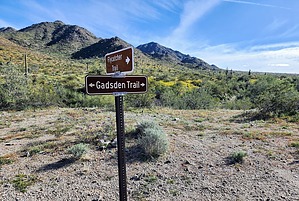
Making Connections by mt98dew  Overview OverviewThe Gadsden Trail is one of 16 trails in Estrella Mountain Regional Park (EMRP). The best way to access this trail is from the Coldwater Trailhead. Note, that there is no water at this TH. However, there is water and bathrooms at the Toothacher Trailhead. This building is visible from the Coldwater TH and is just to the west, past the seasonal RV campers. This trail is 6.5 miles in length, however, it is an interior trail so additional hiking is required. This is at least a 12-mile hike so plan accordingly. To reach the Gadsden Trail one must hike 0.25 miles on the Coldwater Trail and then an additional 0.75 miles on the Butterfield Trail. Hike The Gadsden Trail takes off from Butterfield heading in an eastward direction. Initially, it weaves through some hills before entering an open valley. On clear days you’ll get decent views of the extreme west valley, White Tank Mountains, and Bradshaws. At about 0.6 miles you’ll cross a major wash and then at 0.85 miles, you’ll reach the Flycatcher Trail. This is the newest trail to the EMRP system. The valley isn’t that large, but because of how the trail meanders it will still be about 1.2 miles before you start to climb the hills on the other side. The trail will gradually climb for 0.5 miles before reaching a ridgeline and dropping down into the next valley. From this ridgeline, you can see many of the valley peaks as well as Phoenix Raceway directly in the foreground.
At just over 3 miles the trail starts to turn west returning to and crossing the Gadsden Wash. At 3.28 miles the trail connects to the backside of the Flycatcher Trail. Immediately after the Flycatcher, the trail drops into the wash for a short time before exiting at 3.58 miles. This wash section is one of the nicer aspects of the trail. The rock wall formations are interesting and you get a totally different perspective of the Estrellas. At 3.9 miles the trail connects to the backside of the Butterfield Trail. The trail briefly enters the wash again and then in quick succession passes the Pedersen Trail (4.63), the Coldwater Trail (4.87) and the Toothacher Trail (5.0). From here the trail starts to turn to the southwest, passing through a very sandy stretch. Fairly quickly the landscape starts to open up around you. For a short time, you’ll have some hills off to the north, but to the south and west, you’ll have miles of flat sparsely vegetated views. This does provide for some spectacular views of the Estrellas which tower off to the east. At 5.5 miles the trail loses all originality, becoming a flat, straight 5 ft wide path that seems to extend forever. At 6.25 it gets even “better” changing from smooth flat dirt to deep sandy soil. However, there is a developing use-trail just to the north of this sandy track. At 6.5 miles the Gadsden Trail ends when it junctures with the Pedersen Trail. From this point, you have a few options. The Pedersen (north) or the Toothacher Trails provide nice loop options. The quickest return route to the TH would be returning the way you came and taking the Coldwater Trail.
Check out the Official Route and Triplogs. Leave No Trace and +Add a Triplog after your hike to support this local community. One-Way Notice This hike is listed as One-Way. When hiking several trails on a single "hike", log it with a generic name that describes the hike. Then link the trails traveled, check out the example. | |||||||||||||||||||||||||||||||||||||||||||||||||||||||||||||||||||||||||||||||||||||||||||||||||||||||||||||||||||||||||||||||||||||||||||||||||||||||||||||||||||||||||||||||||


