| Guide | ♦ | 81 Triplogs | 0 Topics |
details | drive | permit | forecast | route |
stats |
photos | triplogs | topics | location |
| 205 | 81 | 0 |
Is there an Uber available by mt98dew  Overview OverviewEstrella Mountain Regional Park is one of 10 county regional parks that make up the Maricopa County Park System. Because of this designation, there is a fee to access this park. It is located about 20 miles west and south of Phoenix in the foothills of the Estrella Mountains. It was established in 1954 with the purchase of 800 acres. Today, Estrella Park stretches for almost 20,000 acres and provides horseback riding, baseball diamonds, a 65-acre grass picnic area, and trails for hiking and biking. The park has 16 trails that extend for 43 miles into the Park. Hike The Pedersen Trail is considered to be an interior trail so some additional hiking is required. This trail forms a large arc going west to east with the apex being at the southern end of the park. Because of where this trail is located within the park it is one of the harder trails to access. There are three ways to access this trail. The standard approach is to park at the Toothacher TH and either hike Toothacher Trail for 3.45 miles (for the western endpoint) or hike the Butterfield/Gadsden for 3.2 miles (eastern endpoint) to reach the beginning of the Pedersen. The other way is to hike in from the Estrella Foothills Community Park. From here you would hike Park Avenue (PA) for 0.6 miles and then the Crossover Trail for 0.9 miles to reach the Pedersen at a midway point. All trails are well-signed at the junctures and there should be no problems following these trails. The nice thing about this last option is that it is about a 2 mile less to reach the Pedersen than the other options. However, you are connecting to the Pedersen Trail when it is already in progress and would have to do some minor route adjusting to do all of the Pedersen. Any of these beginning options will work, but this description is described from the Toothacher/Pedersen juncture.
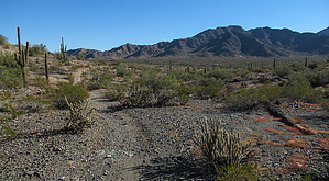
From the Gadsden, the Pedersen follows a straight, flat compact dirt road for 1.3 miles. The scenery and the road do not change, though at 1.85 miles (into the Pedersen Trail) you connect to the beginning of the Homestead Trail. You eagerly anticipate a change to the doldrums. Careful of what you wish for. At 2.8 miles the trail makes a hard left and heads east and becomes a straight and very sandy road that will slowly gain elevation as you hike towards the Estrella’s. This “road” will last for 2.55 miles. As the “road” approaches the Estrella’s you’ll start to distinguish a small hill (on the left side (north)) that stands away from the mountain. The road will circumnavigate this hill and as it does so the road will become less sandy and more rocky. At 5.43 miles the road connects to the Homestead Trail and (finally) changes back to a single track. For the next 2.8 miles, the Pedersen is a single track that will twist and turn as it negotiates numerous washes and plays along the contours of gentle slopes that bleed off of the (still) distant slopes of the Estrella’s. There will be some minor ups and downs with the washes, but the trail will gradually lose elevation as it heads north. Because you are slightly elevated during this stretch your views of the surrounding desert are a little more comprehensive than it is for most of the hike. Early on, you will hike through what I call the “cholla patch”, a rather dense collection of cholla cacti that will vary in intensity as you hike this stretch. At 8.3 miles the Pedersen ends when it connects to the Gadsden Trail. Options are open in getting back to the TH. The Coldwater to the west (left) would be your fastest route back, but the Toothacher (also to the left, but a little further on the Gadsden) and the Butterfield Trail to the east (right on the Gadsden) provide the better trails and more enjoyable experience. Synopsis The Pedersen is unengaging and because of that, a grueling trail. It is approximately a 3-mile hike just to access this trail and then it is an additional 8.3 miles of trails and roads. To start, there is a pleasant 1.6 miles of curves and hills, only to be followed by 4 miles of unchanging, sandy roads. The last 2.8 miles try to redeem the trail with twists and wash crossings that are standard for most trails. It’s a hard sell. The Estrella’s dominate and offer some nice views, the rest of the terrain, though nice, doesn’t change and gets old quickly. This is a big investment in time and miles for little payoff, but if solitude and miles are what you seek, then this trail is for you. Check out the Official Route and Triplogs. Leave No Trace and +Add a Triplog after your hike to support this local community. One-Way Notice This hike is listed as One-Way. When hiking several trails on a single "hike", log it with a generic name that describes the hike. Then link the trails traveled, check out the example. | ||||||||||||||||||||||||||||||||||||||||||||||||||||||||||||||||||||||||||||||||||||||||||||||||||||||||||||||||||||||||||||||||||||||||||||||||||||||||||||||||||||||||||||||||
 Route Editor


