|
tap row or icons for details
|
| Difficulty |
|
1 of 5 |
| Distance One Way |
|
1 mile |
| Trailhead Elevation |
|
2,227 feet |
| Elevation Gain |
|
50 feet |
| Accumulated Gain |
|
225 feet |
| Kokopelli Seeds |
|
1.75 |
| Interest Off-Trail Hiking, Perennial Waterfall & Seasonal Creek | |
| | |
|
|
18 |
2022-04-10 |
Goldfields: 3 peaks and 1 arch |
mikemcg |
|
|
|
18 |
2021-03-10 |
Goldfields Combo |
DixieFlyer |
|
|
|
15 |
2020-12-08 |
Top Hat and the Arches |
DixieFlyer |
|
|
|
26 |
2020-01-15 |
Goldfields Dual Trifecta |
DixieFlyer |
|
|
|
12 |
2019-11-14 |
Top Hat and the Arches Ver 2 |
DixieFlyer |
|
|
|
15 |
2017-01-08 |
Arches & Top Hat via Hackamore |
trekkin_gecko |
|
|
|
62 |
2017-01-08 |
Arches & Top Hat via Hackamore |
tibber |
|
|
|
40 |
2016-11-30 |
Camo Tanks via Pedestal Arch |
CannondaleKid |
|
| | Page 1, 2 |
| |
|
|
list |
map |
done |
Phoenix Region |
| | |
|
| |
|
|
Historical Weather |
| Trailhead Forecast | | |
|
 |
|
|
| Preferred Feb, Jan, Dec, Nov |
|
|
| | |
Named Locations Coordinate Links
| |
|
|
Goldfields: 3 peaks and 1 arch
|
12.19 mi
2,392 ft |
 |
| Top Hat and the Arches
|
6.92 mi
1,315 ft |
|
|
| Goldfields Dual Trifecta
|
9.99 mi
2,259 ft |
|
|
| Top Hat and the Arches Ver 2
|
10.43 mi
2,018 ft |
|
|
| Pedestal Arch from Hackamore TH
|
11.56 mi
1,449 ft |
|
|
| | |
| |
|
|
Overview
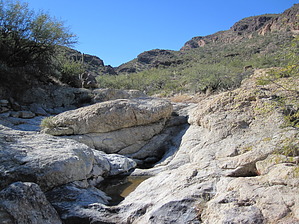
A nice secluded wash few others see that acts as an interesting in-n-out hike or as a connector for longer day hikes or backpacks. It also provides a way to bail out on long bushwhacks in the Goldfields.
One-Way NoticeThis hike is listed as One-Way. When hiking several trails on a single "hike", log it with a generic name that describes the hike. Then link the trails traveled, check out the example. |
 Route Editor


