username
X
password
register
for free!
help


Bagley Tank To Saguaro Lake, AZ

Guide 2 Triplogs  0 Topics
  3 of 5  
Fav
Wish
0
details
drive
permit
forecast
map
stats
photos
triplogs
topics
location
42 2 0
Canyons are inherently risky. Flash floods occur without notice on sunny days. Technical skills & surrounding topography knowledge required yet does not eliminate risk.
Statistics
tap row or icons for details
Distance One Way 2.25 miles
Trailhead Elevation 2,074 feet
Elevation Gain -500 feet
Accumulated Gain 590 feet
Kokopelli Seeds 4.22
 Interest Off-Trail Hiking, Seasonal Waterfall & Seasonal Creek
 Dogs not allowed
feature photo
Photos Viewed All MineFollowing
36  2012-06-07 CannondaleKid
6  2010-12-01 AZLOT69
Author
author avatar Guides 16,843
Routes 17,472
Photos 24
Trips 1 map ( 6 miles )
Age 28 Male Gender
Location HAZ, TrailDEX
Historical Weather
Trailhead Forecast
Expand Map
Preferred Nov, Dec, Jan, Feb
Sun  6:02am - 6:46pm
0 Route
 
0 Alternative


remove free decal offer

 
Guide Needed
Publish Full Detail Guide


Use +Add above to share photos and triplogs
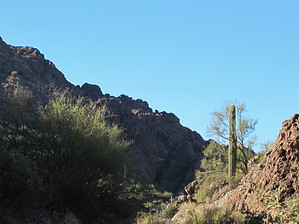
Overview: Fun bushwhack thru a wash requiring a little scrambing. Could be quite fun in wet weather. Towering mountains with a few natural arches if you are observant.


    Check out the Triplogs.
    Leave No Trace and +Add a Triplog after your canyon trip to support this local community.
    WARNING! Hiking and outdoor related sports can be dangerous. Be responsible and prepare for the trip. Study the area you are entering and plan accordingly. Dress for the current and unexpected weather changes. Take plenty of water. Never go alone. Make an itinerary with your plan(s), route(s), destination(s) and expected return time. Give your itinerary to trusted family and/or friends.

     Permit $$
    Information is listed below


     Directions
    or
     Road
    Strictly 4x4

    To canyon trip
    To get to trailhead by vehicle, it is strictly 4 X 4 by accessing Willow Springs Trailhead at milepost 204 on Highway 88 with a Bulldog Canyon Permit. This Trail is part of the Bull Dog Canyon OHV area and an administrative permit can be obtained at no cost from the Mesa Tonto Forest Office. The permit will allow further access beyond the gate for those with a four wheel drive vehicle. For the main access to this trailhead hiking follow the "Willow Springs Canyon to Bagley Tank" hike.
    page created by AZLOT69 on Dec 02 2010 11:56 pm
     90+° 8am - 6pm kills
    helpcorrectionissue

    end of page marker