Route Editor

| Guide | ♦ | 72 Triplogs | 4 Topics |
details | drive | no permit | forecast | route |
stats |
photos | triplogs | topics | location |
| 245 | 72 | 4 |
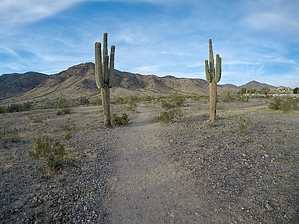
Good to be new by Dartmoor Hiker  Locals adaption before the current Preserve Trails Master Plan. Now follow... Pyramid > Bursera > National > Lost Ranch Mine Trail > Pyramid Bees Knees Trail This hike incorporates the new Bees Knees Trail in area 620 of South Mountain. This is one of the two new trails built in 2010.
To start the hike I followed the directions in an AZ Central article. I went down the gravel road past the yellow end of road sign. After about 1000 feet, turn right up a wash, and after another 1000 feet, you will come to a cairn on the west side of the wash showing the trail's start. You can cut out this first part of the hike by walking up 19th Avenue and crossing the wash at that point. The first part of the trail is reasonably level, and by keeping left at each fork, you will start going up the Bees Knees trail as it traverses the ridge you can see to the north. The Bees Knees trail goes on for about 3 miles when you bear left at another fork to go up the steepish Kebo Trail. The Kebo trail links up with the National Trail after about 0.5 miles, and when you get the National Trail, bear right going north on the National Trail. Follow the National trail for about 2 miles, and before you get to Goat Hill, keep an eye out for a trail on the right-hand side going down. This is the Mine Drop trail. This gets quite steep in places, and the ground is loose so take it slow and easy. Once you get the bottom, follow the cairns into a big wash and follow this wash down until you reach the beginning of the Bees Knees Trail and get back to the trailhead. Note - a more comfortable route round might be to reverse and go up the Mine Drop trail. Check out the Official Route and Triplogs. Leave No Trace and +Add a Triplog after your hike to support this local community. | |||||||||||||||||||||||||||||||||||||||||||||||||||||||||||||||||||||||||||||||||||||