| Guide | ♦ | 3 Triplogs | 0 Topics |
details | drive | no permit | forecast | route |
stats |
photos | triplogs | topics | location |
| 19 | 3 | 0 |
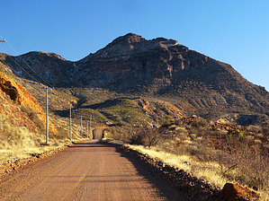
 "Volcano's Vengeance" 4582 foot Clifton Peak rises sharply above Clifton, Arizona. Guarded by cliffs and steep slopes covered in loose talus, this old volcano affords a fantastic view of the surrounding area. There is no trail but the best routes to the peak are likely via the northwest ridge or heading up to the saddle just east of the peak. The last couple of hundred feet of climbing to the rocky summit requires some scrambling on steep rock outcrops, but it doesn't appear technical. Plan on 2+ hours for a round trip hike. Avoid this shadeless peak in summer. "Volcano's Vengeance" 4582 foot Clifton Peak rises sharply above Clifton, Arizona. Guarded by cliffs and steep slopes covered in loose talus, this old volcano affords a fantastic view of the surrounding area. There is no trail but the best routes to the peak are likely via the northwest ridge or heading up to the saddle just east of the peak. The last couple of hundred feet of climbing to the rocky summit requires some scrambling on steep rock outcrops, but it doesn't appear technical. Plan on 2+ hours for a round trip hike. Avoid this shadeless peak in summer.Check out the Official Route and Triplogs. Leave No Trace and +Add a Triplog after your hike to support this local community. | ||||||||||||||||||||||||||||||||||||||||||||||||||||||||||||||||||||||||||||
 Route Editor


