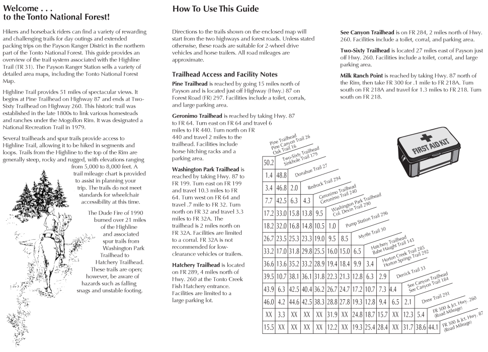
The trail starts on the Rim near the military road built by Gen. George Crook. Access is from either Two-Sixty Trailhead or FR 300; 1.9 miles west of Hwy. 260 (at the Scenic Vista parking lot).
This is probably the easiest trail down the Mogollon Rim in terms of steepness and hazards along the way. Views from the parking area near the start of the trail are spectacular. The trail is as wide as a road although some trees and shrubs are growing on the trail. Ponderosa pine, fern, and oak are the most common plants found along the trail and some interesting rock formations are easily seen.
History
Unsure. The area is influenced by General Crook but perhaps a reference to the Vietnam War term. Clark M. Clifford, the secretary of defense from 1968-1969, advised President Lyndon B. Johnson that it was immoral to consider enormous added investments to Vietnam, calling that a military sinkhole.
When hiking several trails on a single "hike", log it with a generic name that describes the hike. Then link the trails traveled, check out the example.
WARNING! Hiking and outdoor related sports can be dangerous. Be responsible and prepare for the trip. Study the area you are entering and plan accordingly. Dress for the current and unexpected weather changes. Take plenty of water. Never go alone. Make an itinerary with your plan(s), route(s), destination(s) and expected return time. Give your itinerary to trusted family and/or friends.
Permit $$
None
Directions
Road
FR / Dirt Road / Gravel - Car Okay
To Two-Sixty Trailhead From Payson take 260 east. About 5 miles past the second exit to the Christopher Creek loop slow down, watch your back and turn left just past the sign to the 260 trailhead. The turnoff is past Colcord Road and marker 278. There is parking and a permanent toilet at this trailhead.
From PHX (I-10 & AZ-51) 114 mi - about 2 hours 8 mins From TUC (Jct 1-10 & Grant) 212 mi - about 3 hours 28 mins From FLG (Jct I-17 & I-40) 138 mi - about 2 hours 33 mins
page created by joebartels on May 28 2008 10:16 pm
 Route Editor

 The trail starts on the Rim near the military road built by Gen. George Crook. Access is from either Two-Sixty Trailhead or FR 300; 1.9 miles west of Hwy. 260 (at the Scenic Vista parking lot).
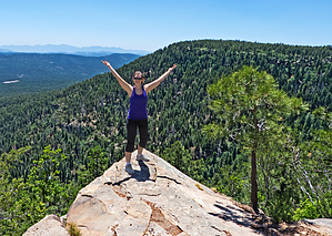


