Morton Peak, CA • Hike
  This is likely a great time to hike this trail!  Check out "Preferred" months below, keep in mind this is an estimate.
  

Morton Peak, CA

Guide 2 Triplogs Mine 0 0 Topics
 
3 of 5 
Fav
Wish
0
details
drive
permit
forecast
route  
stats
photos
triplogs
topics
location
22 2 0
Statistics
tap icons for details
Difficulty 2.5 of 5
Route Finding 1 of 5
Distance Round Trip 5.26 miles
Trailhead Elevation 3,280 feet
Elevation Gain 1,344 feet
Accumulated Gain 1,800 feet
Avg Time Round Trip 3 hours
Kokopelli Seeds 14.26
 Interest Peak
feature photo
Photos Viewed All MineFollowing
10  2018-08-12 DarthStiller
12  2011-03-23 PatrickL
Author
author avatar Guides 7
Routes 62
Photos 1,691
Trips 512 map ( 2,785 miles )
Age 31 Male Gender
Location Phoenix, AZ
Associated Areas
list map done
Big Bear - Jacinto Region
Historical Weather
Trailhead Forecast
Radar Map
Expand Map
Preferred Apr, Nov, Mar, May
Sun  6:04am - 5:53pm
Official Route
 
0 Alternative
 
 Water
Nearby Area Water
[ View More! ]
Flora  Nearby
Culture  Nearby
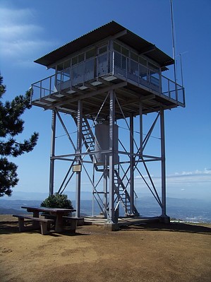
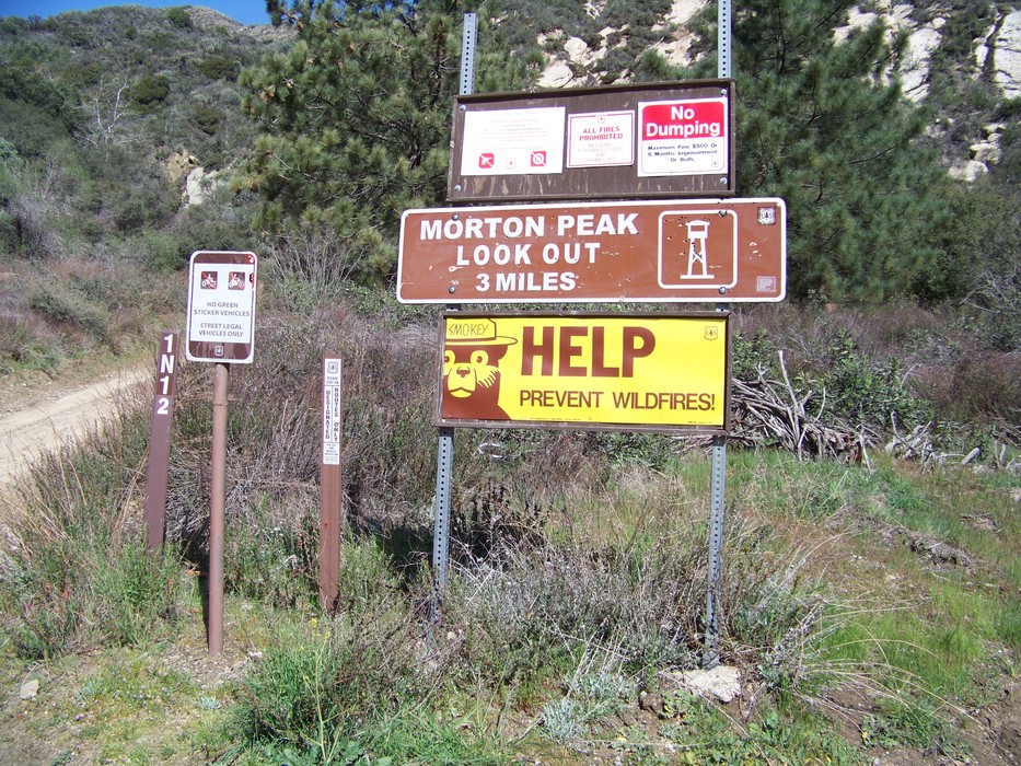
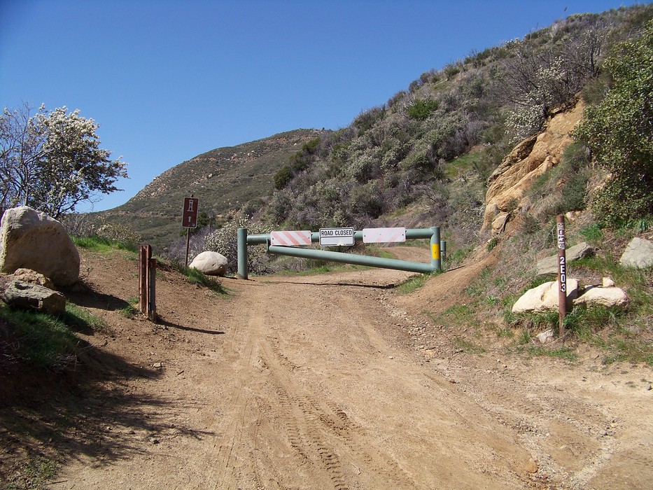
A True Foothill by Comparison
by PatrickL

  Likely In-Season!
Overview: Located in the foothills of the San Bernardino Mountains, Morton Peak rises about 4600ft above sea level. With nearby San Bernardino Peak and San Gorgonio towering thousands of feet over Morton's summit, it could easily be overlooked. Personally, I wouldn't drive very far for this hike, but if you're passing through the area, it's well worth a look see.
Fire Lookout: Originally built in 1934, Morton Peak Lookout was destroyed by a fire in 1959. Since it's reconstruction in 1961 and refurbishment in 2001, it remains a functional fire lookout, as well as a vacation destination for the public. For information on booking a night in the historical fire lookout, visit bigbear.com or call 1-800-4-BIG-BEAR. If you do stay, you have the option of driving to the peak. Road conditions are pretty fair. Might be a little washed out and/or muddy considering snow melt and rain. I saw a couple my first time up and they made the drive in a PT Cruiser. High clearance seems to be recommended. Better safe than sorry.

Hike: The hike begins at a trailhead on the north side of California State Route 38. It follows a forest road for about 1.15 miles before heading west passed a locked gate and up to the peak. Only those staying in the tower have access to unlock the gate. From the gate, it's another mile and a half to the top. The climb is rather gradual, gaining about 680ft. Just below the top, the road passes the Santa Ana River Trail. Granted you didn't arrive on a smoggy day, beautiful 360 degree views, and solitude await you at the top. As if you needed a reminder, please respect the tower and the area in general.

Passes: Parking at Morton Peak's trailhead and its adjacent vista point do not require any recreation fees.

Check out the Official Route and Triplogs.

Gate Policy: If a gate is closed upon arrival, leave it closed after you go through. If it is open, leave it open. Leaving a closed gate open may put cattle in danger. Closing an open gate may cut them off from water. Please be respectful, leave gates as found.

Leave No Trace and +Add a Triplog after your hike to support this local community.

2011-03-24 PatrickL
    WARNING! Hiking and outdoor related sports can be dangerous. Be responsible and prepare for the trip. Study the area you are entering and plan accordingly. Dress for the current and unexpected weather changes. Take plenty of water. Never go alone. Make an itinerary with your plan(s), route(s), destination(s) and expected return time. Give your itinerary to trusted family and/or friends.

     Permit $$
    None

    San Bernadino Forest
    Visit the San Bernadino Passes & Permits for current information


     Directions
    or
    or
     Road
    Paved - Car Okay

    To hike
    From Redlands/Mentone, take Hwy 38 toward Forest Falls/Big Bear. About 2.2 miles passed the Mill Creek Ranger Station, take a left and arrive at the trailhead. Just before the turn, there is a vista point on the right, you can also park here.
    page created by PatrickL on Mar 24 2011 7:39 pm
    helpcorrectionissue

    end of page marker