Overview
Toothaker is an easy roller coaster of a trail. It crosses numerous washes ranging from small to large and can be a tad loose and/or rocky in some sections. The end reward is a nice view of Rainbow Valley and the westernmost peaks of the Sierra Estrella mountains.
Hike
A couple seconds of walking beyond the trailhead will put you in front of two trails, Toothaker and Rainbow. Take the left trail for Toothaker. Both are marked well so getting mixed up is unlikely.
The light ups and downs will begin right away. At times, the trail will be riddled with rocks and gravel, but there will be a clean and level section running alongside. I found the views of the surrounding hills pretty nice. Namely the prominent Peak 1801 to the southeast. The park seems to refer to it as Knob Hill.
Soon after passing the Dysart Trail, you'll dip into the largest wash on the trail. Granted it's not that big, it is notable. Two miles in, you'll meet up with the Rainbow Trail. The trail then climbs over a saddle, the highest point, and begins its gradual 130ft descent towards Rainbow Valley. On your way down, keep an eye out for a crested saguaro about 10ft to the right of the trail. It could very well be the highlight of your trip.
When hiking several trails on a single "hike", log it with a generic name that describes the hike. Then link the trails traveled, check out the example.
WARNING! Hiking and outdoor related sports can be dangerous. Be responsible and prepare for the trip. Study the area you are entering and plan accordingly. Dress for the current and unexpected weather changes. Take plenty of water. Never go alone. Make an itinerary with your plan(s), route(s), destination(s) and expected return time. Give your itinerary to trusted family and/or friends.
To Estrella RP - Rodeo Trailhead Head west on I-10 to Exit 126. Then go south on Estrella Parkway for 5.1 miles. Just over the Gila River, turn left onto Vineyard Ave. In a half-mile soon after the golf course, turn right into the park onto Casey Abbot Dr. After paying the entrance fee, stay on the same road for 2.0 more miles, as it turns south, eventually ending at the rodeo arena.
Toothacher Trailhead is the end lot on W Arena Dr (absolute end)
Which subtly forks from S 143rd Ave ending @ Coldwater Trailhead (0.2 mi before Toothacher)
From PHX (I-10 & AZ-51) - 38 min (28.5 miles) From TUC (Jct 1-10 & Grant) - 2 hr 1 min (127 miles) From FLG (Jct I-17 & I-40) - 3 hr (160 miles)
 Route Editor

 Overview
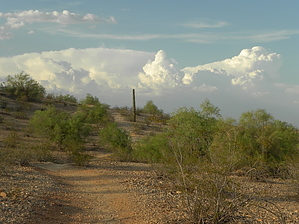


