Route Editor

| Guide | ♦ | 4 Triplogs | 0 Topics |
details | drive | no permit | forecast | 🔥 route |
stats |
photos | triplogs | topics | location |
| 31 | 4 | 0 |
Canyons are inherently risky. Flash floods occur without notice on sunny days. Technical skills & surrounding topography knowledge required yet does not eliminate risk.
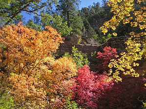
Where's the beef? On the rim! by nonot  Overview OverviewA technical canyoneering trip into Sycamore Canyon. Warning This trip will require technical gear, which should include a helmet, harness, rappelling device, and a locking biner. For this trip add a 60 ft rope, 25 ft webbing, and 2 quick links. The rope pulls should not be problematic, though bringing a backup rope is never a bad idea. A GPS might help, but closely watching for hill 5810 is generally all that is needed for those experienced with back-country navigation. Canyoneering involves traveling through slot canyons. Always check the weather before departing and do not go if there is any chance of rain.
I do NOT recommend anyone attempt this in summer, while the canyon itself is OK, the exit hike is way too hot to attempt this in the summer temps. While you might complete it without heatstroke, it will not be enjoyable. If you do go in summer, start at 4 AM at first light - seriously! History First descent possibly by Joe and Sara DeSalme. A word on beta Beta is often passed around, some being more reliable than others. I found the beta I had on this canyon turned out to be quite inaccurate, from the description of the technical features to the recommendations of times of year to attempt this. In this case, it over-exaggerated the canyon, rather than the opposite. Of course, if I had gotten in over my head, it would have been my fault, not the author. Be careful trusting beta, regardless of the source, it is better to be cautious and go over-prepared than not. Don't blame the beta writers! (Hmm, I wonder what this means to you, reader, sitting there reading this description? :D ) Hike Head down Winter Cabin trail, passing Winter Cabin, and stay on Winter Cabin trail past the junctions with the Hog Hill and Kelsey Winter trail. As you continue to descend the Winter Cabin Trail you will leave the nice forested slopes and get into a shadeless old burn area that is being overgrown by various bushes. In this area is a turn-off to Ott Lake (a seasonal, apparently natural, small lake unlikely to have water in the summer.) The turnoff to see it is neither long nor difficult (nor exciting when it is dry). As you come down the big switchback below the Ott Lake junction you will approach a right turn in the trail as the WC trail will begin to descend a drainage. This is the spot as you approach hill 5810 on your topo map. Leave the trail here and perform a short climb to the saddle left of the hill. Finding game trails, you will reach the minor saddle with a tree in a setting that looks like it came out of the creepy character part of some fable. Proceed down the drainage on the other side of the saddle. Game trails will get you most of the way, but there is a little light bushwhacking. After a bit, another drainage will join from your left. Soon, you will be in the main drainage of Winter Cabin Canyon. As you continue down canyon, you will generally be rock hopping through some minor vegetation. The canyon is generally shaded and pleasant. After a bit, you will reach an easily down-climbed 15 ft ledge and reach, a very short distance later, a crack system you down-climb 6 ft to a ledge on right above a drop of 20 ft. Most will don their harnesses and rappel here, though downclimbing this crack seems possible. Note: it appears obvious from below, but from above it doesn't seem likely. After this rappel comes more rock hopping along with several minor obstacles ranging from 5-12 ft that can be down-climbed. (Note: beginners may want a belay, as a few are a little tricky.) The canyon slots up here and is quite pleasant. After a bit, you will reach the second and last rappel of 25 ft down a nicely sculpted chute in the sandstone. For this rappel, a natural anchor opportunity is available and will require about 10-15 ft of webbing and 60 ft of rope to rig the rappel. If you cannot find a solution and anchor further back, always remember that you can block your rope and use extra stuff (webbing, cord, shoelaces, pants, bras, harnesses of those down already) to extend the pull side. If you are worried, bring longer rope than I have described above. After this rappel, you can take off your harness. Continue rock hopping down canyon, soon you will reach Sycamore canyon. The Winter Cabin trail is about 20 yards back up the canyon on the north side (it was on your right as you headed down canyon towards Sycamore, and is likely marked with several cairns). Head up the Winter Cabin trail, which is very steep in sections. There is very little shade for the lower half of this trail. For this reason, I recommend an early start to your trip. Other than the hike out, this canyon is very low in technical difficulty and would be a good lower-intermediate-level canyon to attempt, which adds more physical strenuousness (due to remoteness and the hike/elevation) without amping up the technical difficulty. Always go in a group with an experienced leader. Don't let yourself fall into the beginner leading beginner trap! Water Sources Winter Cabin Spring, about 200 ft from Winter Cabin, is fairly reliable. Ott Lake is unreliable. Other sources may be present after recent rain, but Winter Cabin is almost entirely dry. Some have reported a small section of water in Winter that can be stemmed over. I didn't observe this (it was bone dry on my attempt) but it is certainly possible it will hold water for a while after a rain. Camping The TH is not conducive to camping but there are other campsites along the drive in. You may share the area with cattle grazing...Moo!
Check out the Official Route and Triplogs. Leave No Trace and +Add a Triplog after your canyon trip to support this local community. | ||||||||||||||||||||||||||||||||||||||||||||||||||||||||||||||||||||||||||||||||||||||||||||||||||||||||||||||||||