username
X
password
register
for free!
help
  🔥

Boulder Bob's Cabin Trail, AZ

Guide 24 Triplogs  3 Topics
  3.3 of 5  
Fav
Wish
5
details
drive
no permit
forecast
🔥
route  
stats
photos
triplogs
topics
location
103 24 3
Statistics
tap row or icons for details
Difficulty 1.5 of 5
Distance One Way 6 miles
Trailhead Elevation 3,382 feet
Elevation Gain 615 feet
Accumulated Gain 800 feet
Kokopelli Seeds 8.67
 Dogs not allowed
feature photo
Photos Viewed All MineFollowing
Will recalculate on button tap!
25  2025-03-22
Boulder Mountain
chumley
43  2025-03-22
Boulder Mountain
John10s
3  2024-09-07
Bear Spring Loop via Bushnell Tanks
pseudalpine
27  2023-12-31
Boulder Bobs Cabin and a mine
The_Eagle
19  2023-12-31
Boulder Bobs Cabin and a mine
Tortoise_Hiker
15  2023-12-31
Boulder Bobs Cabin and a mine
rayhuston
15  2023-12-31
Boulder Bobs Cabin and a mine
LindaAnn
25  2023-12-31
Boulder Bobs Cabin and a mine
JuanJaimeiii
Page 1,  2,  3
Author
author avatar Guides 16,843
Routes 17,472
Photos 24
Trips 1 map ( 6 miles )
Age 28 Male Gender
Location HAZ, TrailDEX
Associated Areas
list map done
Phoenix Region
Historical Weather
Trailhead Forecast
Radar Map
Expand Map
Preferred Mar, Nov, Apr, Feb
Sun  6:03am - 6:45pm
Official Route
 
9 Alternative
 
Historic Fire Perimetersacres
🔥 2020 Bush Fire193.5k
🔥 2005 Edge Complex Fire72.3k
🔥 View (All) - over Official Route 🔥


remove free decal offer

Guide Needed
Publish Full Detail Guide


Use +Add above to share photos and triplogs
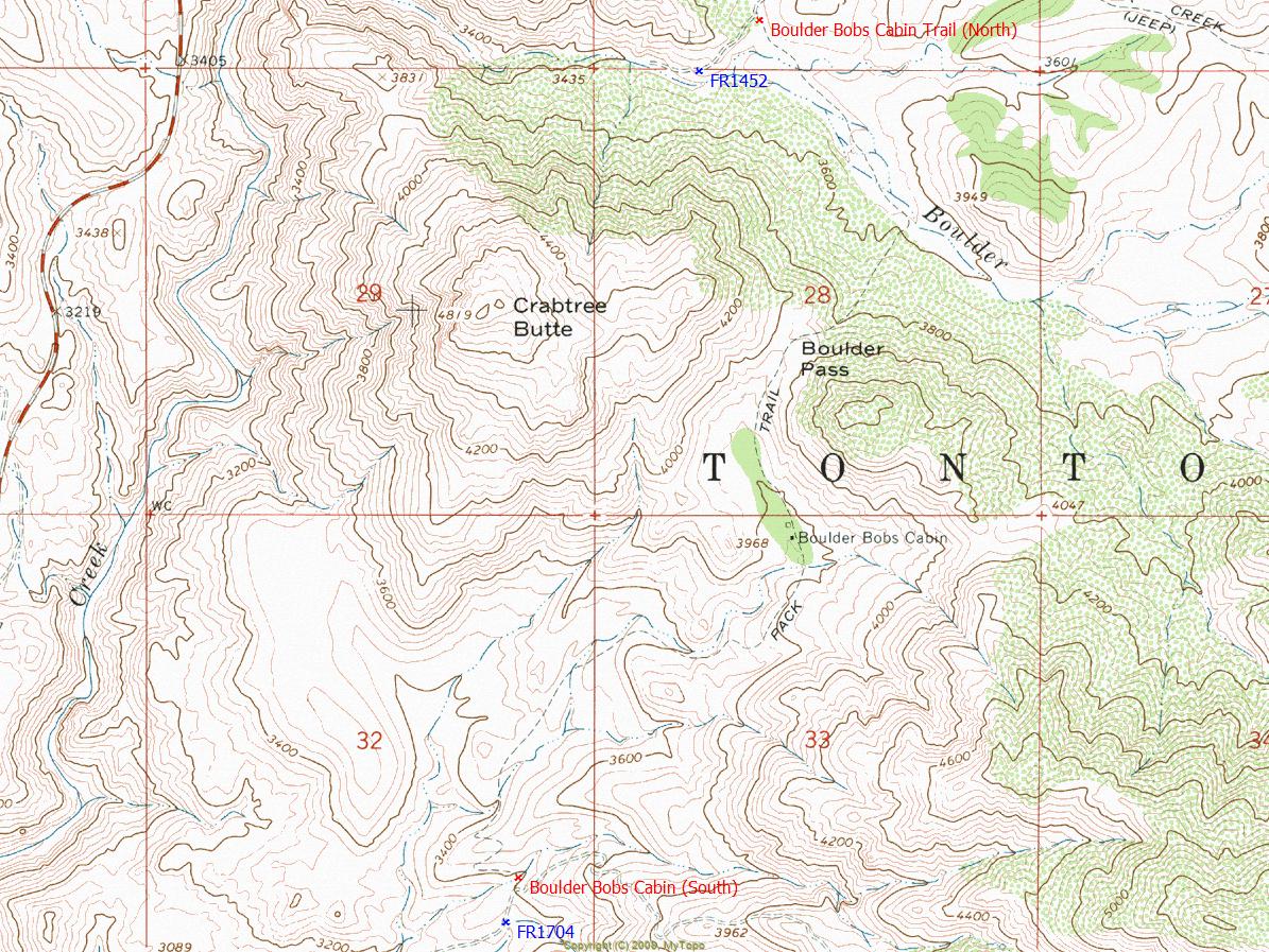
Overview: Can be accessed by car from FR22 signed Bushnell Tanks turnoff at gate or via a rocky 4x4 up FR1704.
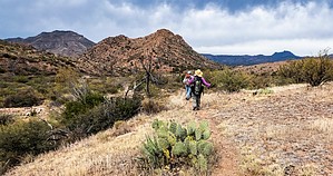
Happy

Trails!


  • guide related image guide related image
    guide related


Check out the Official Route and Triplogs.
Leave No Trace and +Add a Triplog after your hike to support this local community.

One-Way Notice
This hike is listed as One-Way.

When hiking several trails on a single "hike", log it with a generic name that describes the hike. Then link the trails traveled, check out the example.
WARNING! Hiking and outdoor related sports can be dangerous. Be responsible and prepare for the trip. Study the area you are entering and plan accordingly. Dress for the current and unexpected weather changes. Take plenty of water. Never go alone. Make an itinerary with your plan(s), route(s), destination(s) and expected return time. Give your itinerary to trusted family and/or friends.

 Permit $$
None


 Directions
or
 Road
Paved - Car Okay

To hike
page created by joebartels on Jun 08 2008 8:17 pm
 90+° 8am - 6pm kills
helpcorrectionissue

end of page marker