6.4 miles in length. This trail is relatively level and is easily traveled. It follows the rim and passes through stands of Ponderosa pine. Elevation: 6300 - 6800 feet. Difficulty level: Easiest. Use level: Moderate. Restrictions: Closed to all motorized equipment, bike, or other mechanical transport. Trailhead: Carr TH.
No more than 15 people are allowed to be in a group. No more than 15 head of livestock are allowed in a group.
When hiking several trails on a single "hike", log it with a generic name that describes the hike. Then link the trails traveled, check out the example.
WARNING! Hiking and outdoor related sports can be dangerous. Be responsible and prepare for the trip. Study the area you are entering and plan accordingly. Dress for the current and unexpected weather changes. Take plenty of water. Never go alone. Make an itinerary with your plan(s), route(s), destination(s) and expected return time. Give your itinerary to trusted family and/or friends.
 Route Editor

 6.4 miles in length. This trail is relatively level and is easily traveled. It follows the rim and passes through stands of Ponderosa pine. Elevation: 6300 - 6800 feet. Difficulty level: Easiest. Use level: Moderate. Restrictions: Closed to all motorized equipment, bike, or other mechanical transport. Trailhead: Carr TH.
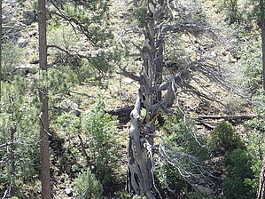


