 Route Editor

| Guide | ♦ | 3 Triplogs | 0 Topics |
details | drive | no permit | forecast | route |
stats |
photos | triplogs | topics | location |
| 85 | 3 | 0 |
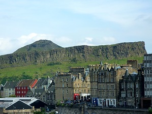
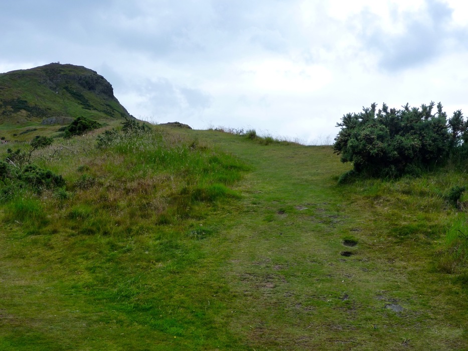
Scotch on the Rocks by chumley Since this description is posted on "Hike Arizona" I will start by saying that Arthur's Seat is the equivalent of Camelback or Squaw Peak in Phoenix. Arthur's Seat is the highest peak in the urban Holyrood Park and features stunning vistas across this medieval city. Plenty of locals get a daily workout here, but it is also the default for any tourists who must get a little bit of exercise. And just as in Phoenix, there are plenty of tourists who make the attempt who have no business being out there. There are however, multiple routes of varying length, difficulty, and danger, providing the visitor options that best suit their skill and comfort levels. Warning Holyrood Park is largely unimproved. There are some short sections of paved trails and a chain rail on the climb approaching the summit, but most of the available hiking is on steep, rocky, and often slippery wet grass or mud (it rains a lot in Scotland!). Proper footwear is the key to making this hike safe and enjoyable.
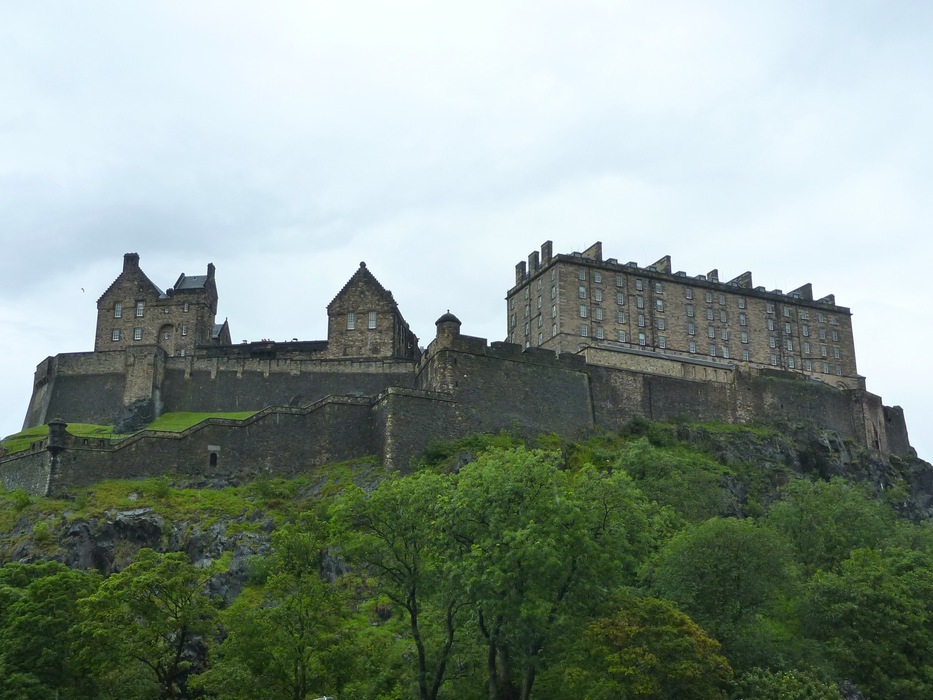
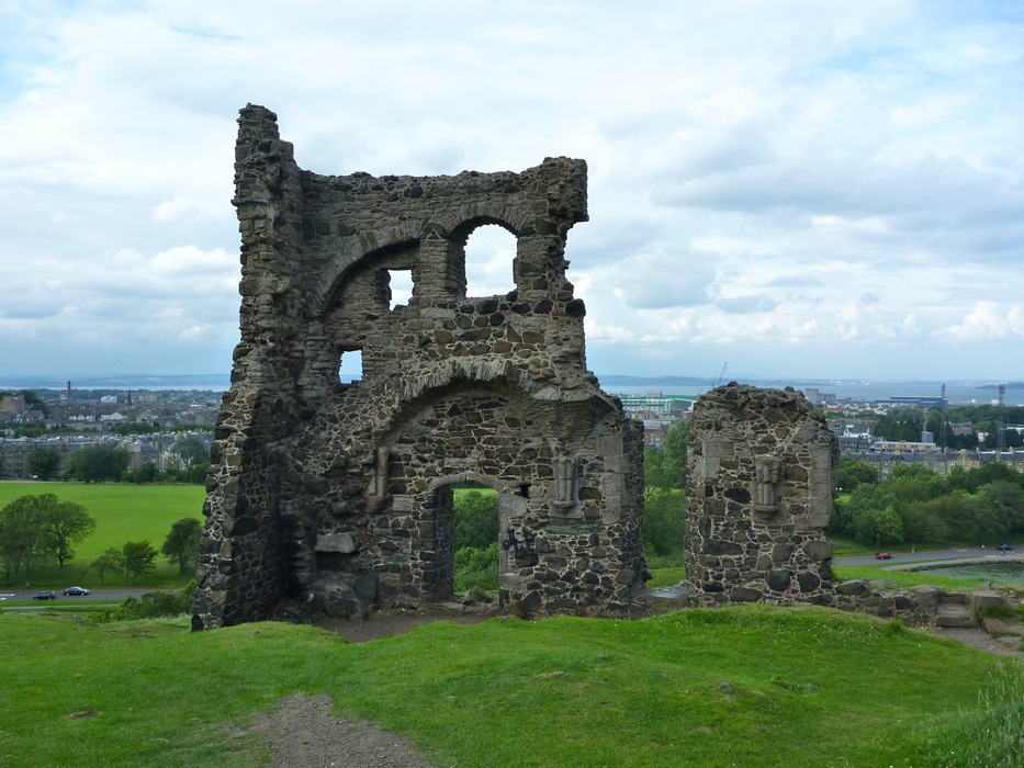
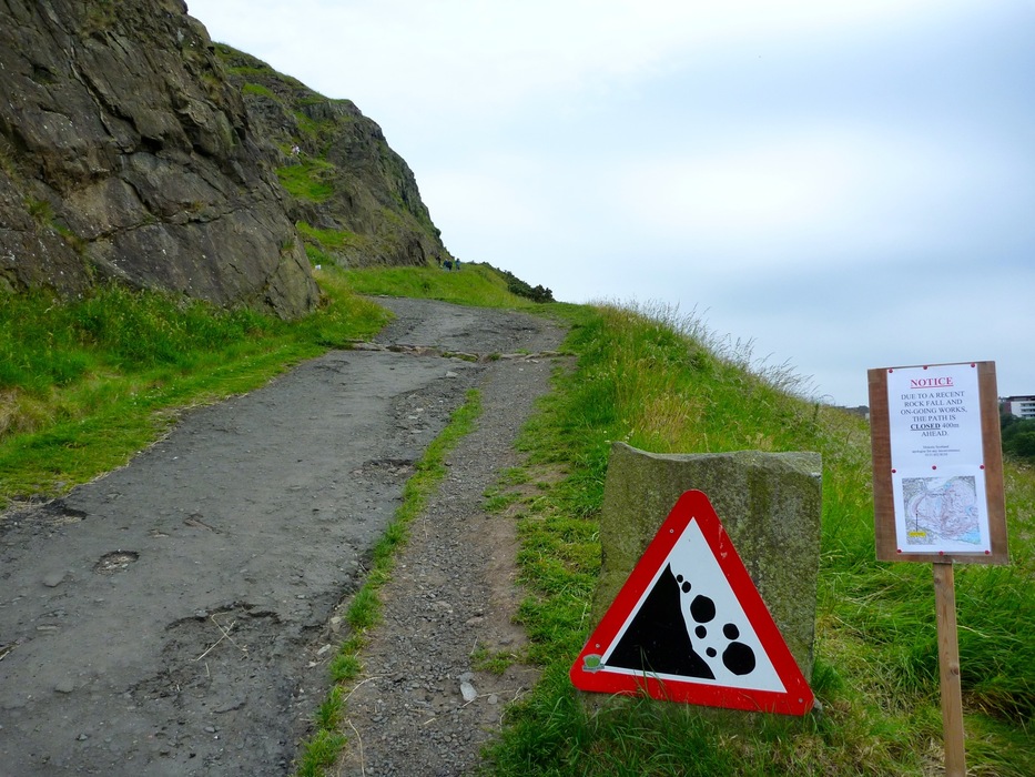
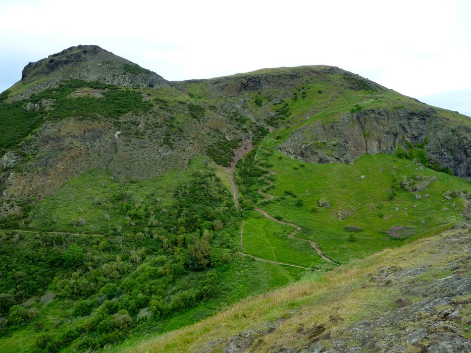
Wiki doesn't seem to know for sure what the source of the name "Arthur's Seat" is, so I won't speculate too far, but there are possible references to King Arthur as well as some traditional Scottish Gaelic phrases. What seems to be quite certain is that the peak and surrounding landscape is the result of an extinct volcano from about 350 million years ago, which was eroded by glaciers in the past 2 million years. There is historical evidence of human settlement in Edinburgh as early as the 6th century BC, and a castle existed in the city as early as the 1100s. There are visible remains of hill forts on Arthur's Seat and adjoining peaks which may date back as far as 600AD. Near the beginning of the hike, the ruins of St. Anthony's Chapel stands on a point above St. Margaret's Loch. It was built in the early 1400s and only one of the original walls remains standing today. Hike From the trailhead at the carpark on Queen's Drive, the main paved trail heads slowly upwards toward St. Anthony's Chapel. Some visitors choose to ascend the "Radical Road" under the Salisbury Crags to the right, but that road was closed due to a rockslide the day I was there. There are multiple trails throughout Holyrood Park, though none of them is marked with any signage. The first heads to the right and up on top of the Salisbury Crags. In the loop I am describing, this is the trail that you will return on. A major fork in the trail occurs next, with the right fork heading upwards into the Hunter's Bog, a peaceful valley with fewer visitors as views of the city are obstructed by the higher elevations which surround it. Stay to the left and head uphill toward the chapel ruins. Take the short spur trail to the left and out to the ruins before heading back to make the ascent. Here, the primarily used route is in the drainage, but I chose the less-traveled, and more scenic route along the what some maps refer to as "The Lang Rig" or "The Dasses" (a high ridge and cliff parallel to the drainage about 100m to the right of the main trail). The footing here would be difficult when wet as it was nothing more than nicely trampled grass. The two parallel routes come together at a saddle between Arthur's Seat and Whinny Hill. Turn to the right and head up the final climb to the summit. Here the trail is jagged and rocky in places, while manmade stone steps assist in other areas. A chain rail has been erected to assist, though I felt there were other parts of the park which could have used such assistance much more than this section. At the peak, take some time to enjoy the 360-degree views across the city, the surrounding countryside, the Firth of Forth, the Isle of May, and the North Sea. The descent begins by heading south down the steep rut in the rocks toward Nether Hill. At the saddle you will find that visitors have erected numerous signs and formations using the many loose rocks available in the park. From here, the trail descends steeply down a marvelous trail, with numerous switchbacks, difficult footing and great views. (It might be called the Gutted Haddie on some maps). If you don't like heights or steep and narrow trails, choose another route to get down. But for me, this was a highlight of the hike. The bottom of the switchbacks ends at a junction of trails at the top of Hunter's Bog and the far end of the Salisbury Crags. From here you can return to the trailhead on one of three routes: the trail through Hunter's Bog, the "Radical Road" below Salisbury Crags, or along the top of the crags. I chose to climb up and walk along the edge of the crags, stopping for more stunning views and photos over the city and back across Holyrood Park. As the trail descended back to the trailhead stay to the right and join up with the paved trail where you began the hike before turning left and returning to the trailhead at the carpark. It is possible to descend more directly to the carpark, but I wouldn't recommend it unless you are really an off-trail adventurer! The distance and terrain allow this loop to be completed in less than an hour, but that doesn't allow time to stop and enjoy the views or take photographs. If it's your first time here, I would plan on a minimum of 3 hours to complete the loop in an enjoyable fashion. Check out the Official Route and Triplogs. Leave No Trace and +Add a Triplog after your hike to support this local community. | |||||||||||||||||||||||||||||||||||||||||||||||||||||||||||||||||||||||||||||||||||||


