Route Editor

| Guide | ♦ | 3 Triplogs | 0 Topics |
details | drive | no permit | forecast | 🔥 route |
stats |
photos | triplogs | topics | location |
| 15 | 3 | 0 |
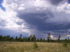
Thar be caves under them hills by nonot  Overview OverviewAn easy stroll out to 3 large sinkholes on the rim, making partial use of old roads. Warning There's no water on this hike - bring some with you. There is also no shade, so bring sun protection.
Sinkholes are formed when voids formed below the earth collapse. The rim is rich with caves due to the karst process working on the Coconino sandstone layer. The age and size of these sinkholes suggest that the karst processes are located relatively deep in this area and likely well sealed off, considering the age of the trees growing within and the collapse volume. Hike From 260, either hike or drive the half-mile of FR9535J until you reach the gate. Past this is closed to vehicles. Go through the gate (close it behind you, please) and proceed hiking south along the old extension of the road. After a bit, the road starts meandering straight east. Hike south for a bit cross-country, and you may pick up an even older road. A short bit later and you can identify the first sinkhole to the west off the road, which is the smallest. Next to it, a bit to the south, is its much larger brother. Hiking further west another 5 minutes will bring you to the third and last sinkhole of significance in the Mule Creek Point area. This last sinkhole provided the much-desired shade for a rather startled mulie doe on my visit. Searching the area, I did not locate any possible entrances to the cave system that must lurk below. Perhaps it's for the best as due to all these collapses, there might be very little left underground in this particular area. Return the way you came or continue to explore out to Mule Creek Point itself. Water Sources None Camping Possible, though the Rodeo Chediski fire has burned down almost all the trees, so you would be at the mercy of the winds. Gate Policy: If a gate is closed upon arrival, leave it closed after you go through. If it is open, leave it open. Leaving a closed gate open may put cattle in danger. Closing an open gate may cut them off from water. Please be respectful, leave gates as found. The exception is signage on the gate directing you otherwise. Check out the Official Route and Triplogs. Leave No Trace and +Add a Triplog after your hike to support this local community. | |||||||||||||||||||||||||||||||||||||||||||||||||||||||||||||||||||||||||||||||||||||||||||