Route Editor

| Guide | ♦ | 3 Triplogs | 0 Topics |
details | drive | no permit | forecast | 🔥 route |
stats |
photos | triplogs | topics | location |
| 29 | 3 | 0 |
Canyons are inherently risky. Flash floods occur without notice on sunny days. Technical skills & surrounding topography knowledge required yet does not eliminate risk.
Sandstone Narrows, Mind Wanders by nonot  Overview OverviewA technical canyoneering trip into Mooney Canyon. Warning Canyoneering involves slot canyons, always check the weather before you leave and do not go if there is any chance of rain. Since this trip is technical, you will need a: Helmet!, harness, rappelling device and locking biner, 100 ft rope, 2 rap rings, and 20 ft webbing. Wetsuits are probably unnecessary. You will want sun protection (hat and sunscreen) for the hike up Mooney Trail #12. Bring extra water for this shadeless ascent!
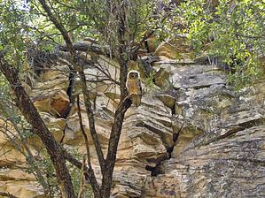
History Described in Todd Martin's book: "Arizona: Technical Canyoneering". Hike From the parking spot, take FR626B east until the road ends. Downclimb into the canyon here, being careful of your footing as the pine needles are slippery. At the bottom, it is a bit of a thrash for a while until the canyon gets a little deeper. You will downclimb a 20 ft drop right away and soon come to a 15 ft rappel/downclimb. Thinking this was the only rappel described in the book (from above, downclimbing seems unlikely) we rappeled this and were able to stay dry. Continuing downcanyon, hop over logs and test yourself at a series of three tests - can you stay dry? After these tests of agility, you will come to the mandatory rappel of about 25 ft into chest-deep water. After this, you can pack up your technical gear. As you continue downcanyon you will enter a very attractive length of sandstone narrows. The scenery is eye candy as the narrows twist and turn. Along the way, you will downclimb and stem over many more pools. At one point the slot is choked by enormous vegetation piles. A word of warning: You will encounter a formidable keeper pothole along the way. Upon inspection, the water was 2 ft below the rim and it is reported to be at least 7 ft deep. A bypass trail exists on canyon right around this obstacle. If you are not prepared to face this formidable challenge - it is recommended you take the bypass! Eventually, the canyon will widen as it joins with Mooney canyon. Good elk trails soon appear and it is imperative that you find them. In one place in particular a very good elk trail will be on the west side of the canyon and proceed for at least a half-mile bypassing high above the boulder cluttered canyon floor - allowing one to see the beauty without working as hard for it. Eventually, Mooney will junction with the Mooney Trail #12. This proceeds close to a barbed wire fence and is a rather shadeless 1000 ft climb up broken-down sandstone ledges until it reaches Taylor Cabin TH. I recommend you bring sun protection (hat and sunscreen) as well as extra water for each person. Due to the exit, the canyon is likely much more pleasant in spring or fall than in summer. Even though the canyon isn't very technical it has very nice narrows and the hike down Mooney is quite wonderful. The Mooney Trail #12 is a necessary evil but allows for an easy return to the rim. Water Sources Nothing that was appetizing. Camping Mooney Canyon had several campsites, but no water source was located. Camping on the rim is certainly possible in many places.
Check out the Official Route and Triplogs. Leave No Trace and +Add a Triplog after your canyon trip to support this local community. | ||||||||||||||||||||||||||||||||||||||||||||||||||||||||||||||||||||||||||||||||||||||||||||||||||||||||||||