username
X
password
register
for free!
help


Sheep Tank - Pinaleno Mtns, AZ

Guide 6 Triplogs  0 Topics
  3 of 5  
Fav
Wish
0
details
drive
no permit
forecast
map
stats
photos
triplogs
topics
location
17 6 0
Statistics
tap row or icons for details
Difficulty 1 of 5
Distance Round Trip 5 miles
Trailhead Elevation 3,321 feet
Elevation Gain 275 feet
Kokopelli Seeds 6.38
unreported if dogs are allowed
editedit > ops > dogs to adjust
feature photo
Photos Viewed All MineFollowing
5  2012-03-17 SkyIslander18
12  2011-09-04 SkyIslander18
Author
author avatar Guides 16,843
Routes 17,472
Photos 24
Trips 1 map ( 6 miles )
Age 28 Male Gender
Location HAZ, TrailDEX
Associated Areas
list map done
Tucson Region
Historical Weather
Trailhead Forecast
Expand Map
Preferred Nov, Mar, Feb, Jan
Sun  5:56am - 6:40pm
0 Route
 
0 Alternative


remove free decal offer

 
Guide Needed
Publish Full Detail Guide


Use +Add above to share photos and triplogs
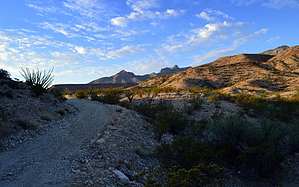
Overview: Easy 2.5 mile hike (one way) along a 4X4 dirt road leading to a small reservoir with excellent views of the northeastern Pinaleno mountains.


    Check out the Triplogs.
    Leave No Trace and +Add a Triplog after your hike to support this local community.
    WARNING! Hiking and outdoor related sports can be dangerous. Be responsible and prepare for the trip. Study the area you are entering and plan accordingly. Dress for the current and unexpected weather changes. Take plenty of water. Never go alone. Make an itinerary with your plan(s), route(s), destination(s) and expected return time. Give your itinerary to trusted family and/or friends.

     Permit $$
    None


     Directions
    or
     Road
    High Clearance possible when dry

    To hike
    From the highway 70/highway 191 junction in Safford, head west on highway 70 for 3.75 miles to Reay Lane in Thatcher, AZ. Turn south onto Reay Lane (milepost 335.65) and follow it for 1.2 miles. At the 1.2 mile point, there will be an unmarked dirt road to the right (west) just before the auto wrecking yard. Turn right (west) onto this dirt road, it is forest road 103. Follow forest road 103 for about 3.5 miles and turn left onto the unmarked dirt road. There will be a large parking area to the left a short distance down the road.
    page created by SkyIslander18 on Sep 04 2011 12:11 pm
     90+° 8am - 6pm kills
    helpcorrectionissue

    end of page marker