Route Editor

| Guide | ♦ | 10 Triplogs | 0 Topics |
details | drive | no permit | forecast | 🔥 route |
stats |
photos | triplogs | topics | location |
| 96 | 10 | 0 |
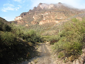
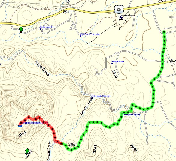
Express Delivery! by CannondaleKid  When hiking Picketpost on the normal route from the trailhead just off the US 60, you get a 1.5-mile warm-up before the 1-mile climb to the plateau. Not from the east... The drive to the TH will be challenging enough for most hikers, and then you barely have a 100-yard warm-up before beginning the roughly 0.9-mile climb to the northeast corner of the plateau. Your route will vary, and you will likely seek an easier route on the return, so your route selection skills will be put to the test. Although I did not successfully reach the summit on my first attempt, I am confident that the route is doable. I was within 300' of altitude of the horseshoe cross when I had to turn back due to the weather fast-closing to the point I could not see 20' ahead. Another attempt is coming very soon, when I will also try a completely different (and steeper) return route. When hiking Picketpost on the normal route from the trailhead just off the US 60, you get a 1.5-mile warm-up before the 1-mile climb to the plateau. Not from the east... The drive to the TH will be challenging enough for most hikers, and then you barely have a 100-yard warm-up before beginning the roughly 0.9-mile climb to the northeast corner of the plateau. Your route will vary, and you will likely seek an easier route on the return, so your route selection skills will be put to the test. Although I did not successfully reach the summit on my first attempt, I am confident that the route is doable. I was within 300' of altitude of the horseshoe cross when I had to turn back due to the weather fast-closing to the point I could not see 20' ahead. Another attempt is coming very soon, when I will also try a completely different (and steeper) return route.Picketpost from the west is something any hiker in decent shape can do... Picketpost from the east? Well, this one will separate the men/women from the boys/girls. You'll need good climbing skills (no ropes!) and plenty of stamina, along with a willingness to travel up steep and at many times loose terrain that may slide with no prior warning. But for those who consider themselves worthy of a challenge (albeit a short one), it's a great way to see and experience awesome views from a completely new vantage point.
Check out the Official Route and Triplogs. Note This is a more difficult hike. It would be unwise to attempt this without prior experience hiking. Leave No Trace and +Add a Triplog after your hike to support this local community. | |||||||||||||||||||||||||||||||||||||||||||||||||||||||||||||||||||||||||||||||||||||||||||||||||||||||||||||