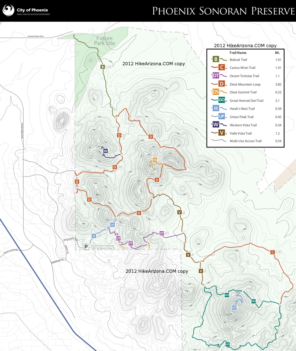
An out and back hike of about 2 miles or serves as a connection to the Dixie Mountain Loop, and the rest of the Sonoran Preserve trails system beyond. The trail begins at the eastern end of Sonoran Desert Drive. There is no designated or nearby parking, only walk-in access. The trail crosses two large washes, meanders along gently rolling hills before ending at the 2.25 milepost of the Dixie Mountain Loop.
When hiking several trails on a single "hike", log it with a generic name that describes the hike. Then link the trails traveled, check out the example.
WARNING! Hiking and outdoor related sports can be dangerous. Be responsible and prepare for the trip. Study the area you are entering and plan accordingly. Dress for the current and unexpected weather changes. Take plenty of water. Never go alone. Make an itinerary with your plan(s), route(s), destination(s) and expected return time. Give your itinerary to trusted family and/or friends.
Permit $$
None
Directions
Road
Paved - Car Okay
To Desert Vista Trailhead From I-17 and Jomax Rd, take Jomax to it's east end. Turn left on North Valley Pkwy, right on Copperhead Trail, left on Melvern Trail, and right on Desert Vista Trail to go behind the neighborhood community center. Desert Vista dead ends at the trailhead parking lot. Studying a map before you go is recommended as the trailhead is somewhat hidden in the neighborhood.
Address: 1901 W Desert Vista Trail, Phoenix
From PHX (I-10 & AZ-51) 29.4 mi, 34 mins From TUC (Jct 1-10 & Grant) 134 mi, 2 hours 4 mins From FLG (Jct I-17 & I-40) 122 mi, 1 hour 54 mins
 Route Editor

 An out and back hike of about 2 miles or serves as a connection to the Dixie Mountain Loop, and the rest of the Sonoran Preserve trails system beyond. The trail begins at the eastern end of Sonoran Desert Drive. There is no designated or nearby parking, only walk-in access. The trail crosses two large washes, meanders along gently rolling hills before ending at the 2.25 milepost of the Dixie Mountain Loop.


