|
tap row or icons for details
|
| Difficulty |
|
1.5 of 5 |
| Distance One Way |
|
7.5 miles |
| Trailhead Elevation |
|
1,924 feet |
| Elevation Gain |
|
435 feet |
| Accumulated Gain |
|
766 feet |
| Kokopelli Seeds |
|
10.05 |
| Interest Off-Trail Hiking & Seasonal Creek | | unreported if dogs are allowed
editedit > ops > dogs to adjust |
| | |
|
|
14 |
2023-02-04 |
Golden Dome |
trekkin_gecko |
|
|
|
18 |
2023-02-04 |
|
|
|
29 |
2022-04-23 |
Goldfield Overlook & Kissing Turtles Arches |
John10s |
|
|
|
34 |
2019-11-24 |
Goldfields Meander |
mr_squishy |
|
|
|
42 |
2019-11-22 |
Goldfields Golden Dome and Peak 3141 |
mr_squishy |
|
|
|
20 |
2019-02-06 |
Goldfields: Golden Dome and Peak 3141 |
DixieFlyer |
|
|
|
3 |
2018-11-09 |
An Overlooking Arch |
hikerdw |
|
|
|
25 |
2017-03-04 |
Trans Goldfield |
hikingaz2 |
|
| | Page 1, 2 |
| |
|
|
list |
map |
done |
Phoenix Region |
| | |
|
| |
|
|
Historical Weather |
| Trailhead Forecast | | |
|
 |
|
|
| Preferred Feb, Jan, Dec, Nov |
|
|
| | |
Named Locations Coordinate Links
| |
|
| Crown Butte Arroyo
|
8.41 mi
672 ft |
|
|
|
Golden Dome
|
12.4 mi
2,828 ft |
 |
| Goldfields Meander
|
8.32 mi
894 ft |
|
|
| Goldfields Golden Dome and Peak 3141
|
12.3 mi
2,829 ft |
|
|
| Goldfields: Golden Dome and Peak ...
|
12.4 mi
2,983 ft |
|
|
| An Overlooking Arch
|
13.23 mi
2,101 ft |
|
|
| Trans Goldfield
|
14.21 mi
2,525 ft |
|
|
| | |
| |
|
|
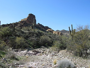
Overview: This scenic seldom traveled bushwhack route connects the high country(Gateway Canyon) of the western Goldfields to Packsaddle trail in the eastern Goldfields.
One-Way NoticeThis hike is listed as One-Way. When hiking several trails on a single "hike", log it with a generic name that describes the hike. Then link the trails traveled, check out the example. |
 Route Editor


