username
X
password
register
for free!
help
 

Dry Canyon - Gila Box RNCA, AZ

Guide 13 Triplogs  0 Topics
  3.5 of 5  
Fav
Wish
0
details
drive
no permit
forecast
map
stats
photos
triplogs
topics
location
69 13 0
Canyons are inherently risky. Flash floods occur without notice on sunny days. Technical skills & surrounding topography knowledge required yet does not eliminate risk.
Statistics
tap row or icons for details
Distance One Way 0 miles
Trailhead Elevation 3,104 feet
 Interest Off-Trail Hiking
unreported if dogs are allowed
editedit > ops > dogs to adjust
feature photo
Photos Viewed All MineFollowing
22  2021-11-25
Dry Canyon
markthurman53
7  2018-03-01 cactuscat
16  2017-01-13 SkyIslander18
12  2016-12-01 cactuscat
15  2012-06-16 SkyIslander18
19  2012-02-08
Gila Box RNCA
SkyIslander18
Author
author avatar Guides 16,843
Routes 17,472
Photos 24
Trips 1 map ( 6 miles )
Age 28 Male Gender
Location HAZ, TrailDEX
Historical Weather
Trailhead Forecast
Expand Map
Sun  5:55am - 6:38pm
3 Routes
 
1 Alternative


remove free decal offer

Guide Needed
Publish Full Detail Guide


Use +Add above to share photos and triplogs
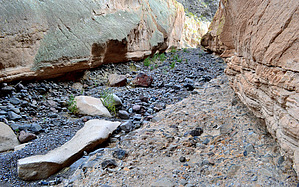
Overview: Dry Canyon is one of several large washes within the Gila Box National Conservation Area that runs down off the Gila Mountains to meet the Gila River.


    Check out the Triplogs.
    Leave No Trace and +Add a Triplog after your canyon trip to support this local community.
    WARNING! Hiking and outdoor related sports can be dangerous. Be responsible and prepare for the trip. Study the area you are entering and plan accordingly. Dress for the current and unexpected weather changes. Take plenty of water. Never go alone. Make an itinerary with your plan(s), route(s), destination(s) and expected return time. Give your itinerary to trusted family and/or friends.

     Permit $$
    None


     Directions
    or
     Road
    FR / Jeep Road - Car possible when dry

    To canyon trip
    From Safford, travel approximately five miles east on U.S. Highway 70 to the town of Solomon and turn left onto Sanchez Road. Travel north for eight miles, crossing the bridge at the Gila River, to a Gila Box RNCA sign. Turn left onto that dirt road. Travel another 2.7 along Bonita Creek Rd and turn right into the Dry Canyon boat take out area and park. Dry Canyon is to the north of the Gila River across the road.
    page created by SkyIslander18 on Jun 28 2012 7:59 am
     90+° 8am - 6pm kills
    helpcorrectionissue

    end of page marker