| Guide | ♦ | 3 Triplogs | 1 Topic |
details | drive | permit | forecast | 🔥 route |
stats |
photos | triplogs | topic | location |
| 70 | 3 | 1 |
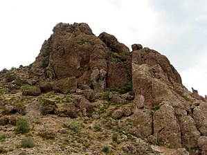
Not for the exposure challenged! by CannondaleKid  Overview OverviewAjax Benchmark is located in the Mineral Mountain Quadrangle, which is just south of the US 60 between Florence Junction and Superior. Typical of peaks in the Mineral Mountain Quad, the drive to the trailhead is every bit as much of a challenge as the actual climb, and Ajax Benchmark is no different. Depending on the capability of your vehicle and how far you are willing to drive it, this hike can be as short as 1.5 miles to more than 8 miles round-trip. Elevation gain and time will be as much or as little as you feel comfortable with. Hike From the trailhead probably the simplest route is to head straight east directly toward the mountain, dropping down to the saddle just below the TH then following the slope up and just to the north (left) of Ajax Benchmark. Although the summit approach itself is on the SSW face, I was not aware of it so I continued clockwise around the peak until locating it, about 3/4 the way around. Although I did not attempt it on the return, I'm not so sure circling 1/4 the way counter-clockwise would be any easier as there appears to be much more exposure in that direction. I ultimately followed the ridge straight south until connecting with the old no-longer-in-use section of the Great Enchantment Trail which I followed back to the saddle below the trailhead then back up to the trailhead. So you can either do this as an out-and-back or make a loop, wandering where ever your curiosity takes you. Check out the Official Route and Triplogs. Leave No Trace and +Add a Triplog after your hike to support this local community. | ||||||||||||||||||||||||||||||||||||||||||||||||||||||||||||||||||||||||||||||||||||||||||||||||||||||
 Route Editor


