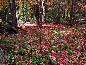
.. Prime Autumn with Big Tooth Maple .. by Grasshopper
Overview
East Bear Canyon "off-trail" hiking can be compared to hiking sections of our Mogollon Rim- Barbershop Canyon and Dane Canyon with seasonal water flow and pooling within East Bear Canyon as of this August'12 hike description posting.
In Autumn, with surprisingly numerous large stands of "Big Tooth Maple" within the entire East Bear Canyon section, this LOOP should provide some excellent Autumn colors during prime season.
East Bear Canyon drainage is mostly easy to navigate with numerous animal routes to follow with some downed trees to negotiate. The lower East Bear Canyon secondary drainage "exit" point to reach remote FR9032E will require some tolerance and patience due to downed trees, overgrowth, and required route finding skills (see my posted 8/23/12 "official" GPS Route with key waypoints noted). It is highly recommended to download and follow this "official" 8/23/12 GPS Route posted herein.
Please Note
The recommended, easier to navigate loop option (with less bushwhacking/tree downfall/route finding) for this hike description is to continue past the above noted lower East Bear Canyon secondary drainage "exit" point, continuing down the East Bear Canyon drainage to its intersection at Bear Canyon Upper then continue off-trail and uphill to intersect the lower end of FR300G (for this hiking route section to reach FR300G from the intersection of the lower end of East Bear Canyon at Bear Canyon Upper, it is highly recommended to download and follow the posted hike description "alternate" 9/27/12 GPS Route..with all key waypoints included). This recommended hike option (utilizing 1.8 miles on FR300G) now makes this a 5.1-mile loop.
WARNING! Hiking and outdoor related sports can be dangerous. Be responsible and prepare for the trip. Study the area you are entering and plan accordingly. Dress for the current and unexpected weather changes. Take plenty of water. Never go alone. Make an itinerary with your plan(s), route(s), destination(s) and expected return time. Give your itinerary to trusted family and/or friends.
Permit $$
None
Directions
Road
High Clearance possible when dry
To hike From the Phoenix area- Drive Hwy 87 north through Payson, Pine, and Strawberry.. approx 10.5 miles north of Strawberry on Hwy 87 at MP281.1, turn right at signed FR300 (the Rim Road) and continue on FR300 for ~14.5 miles to the intersection with signed FR300G. Turn left onto FR300G and continue for ~0.90 miles to the easily missed FR9737Y intersection on the right side (small water tank visible), which is the Parking/TH Start for this "off-trail" hike (at waypoint 34.43827 -111.21574). It is highly recommended you download and follow the Driving Route (with key waypoints) posted above to this guide;
page created by Grasshopper on Aug 29 2012 4:41 pm
 Route Editor

 Overview