When hiking several trails on a single "hike", log it with a generic name that describes the hike. Then link the trails traveled, check out the example.
WARNING! Hiking and outdoor related sports can be dangerous. Be responsible and prepare for the trip. Study the area you are entering and plan accordingly. Dress for the current and unexpected weather changes. Take plenty of water. Never go alone. Make an itinerary with your plan(s), route(s), destination(s) and expected return time. Give your itinerary to trusted family and/or friends.
Permit $$
None
Directions
Road
FR / Dirt Road / Gravel - Car Okay
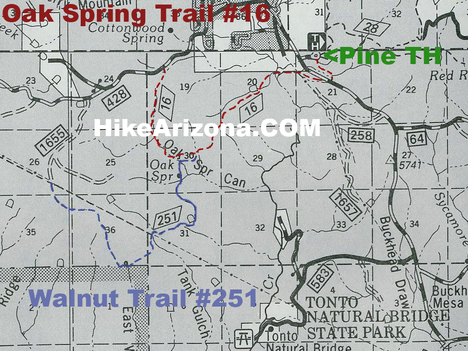
To Pine Trailhead 87 north to Payson. Continue through Payson on 87 @12 miles to Pine Trailhead. The Trailhead sign will be on your right.
Pine Trailhead is a very well maintained trailhead, with vault toilets and neat horse corrals. A very short distance from the trailhead is a mountain cabin where some lucky person lives.
From PHX (I-10 & AZ-51) 102 mi - about 1 hour 55 mins From TUC (Jct 1-10 & Grant) 200 mi - about 3 hours 15 mins From FLG (Jct I-17 & I-40) 98.9 mi - about 1 hour 44 mins
 Route Editor


 This trail is part of the Arizona Trail. Oak Spring is a beautiful wooded setting.
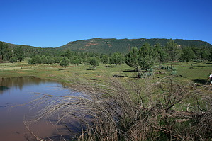


