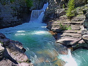
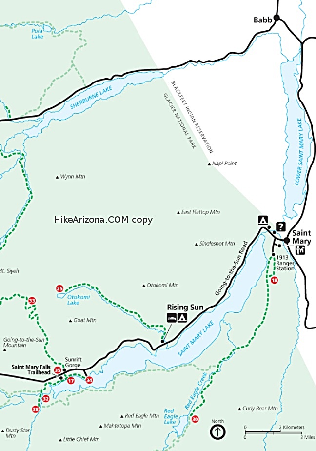
SAINT MARY FALLS: .8ml one way(+35ft); VIRGINIA FALLS: 1.55mls one way(+110ft); These two very popular falls are a short hike off the historic "Going-to-the-Sun-Road". The Saint Mary Falls trail receives heavy use, is well maintained, and is easy to hike. The dense, deep-green forest is made up mostly of Douglas fir and maple trees. The grown cover consists mainly of beargrass, snowberry, and thimbleberry bushes. This beautiful trail setting parallels Virginia Creek prior to arriving at a footbridge crossing the mighty flowing St. Mary River for a close-up view of Saint Mary Falls. Continuing past the footbridge, you parallel the confluence of the St. Mary River and Virginia Creek. Huge volumes of water converge here, most notably in June and early July when the alpine snowfields melt. Soon you will hear the thundering roar on the approach to Virginia Falls long before your arrival. The water that feeds thundering and misty Virginia Falls mostly comes from Citadel Mtn and Almost-A-Dog Mtn areas to the south...SWEET IT IS!!
WARNING! Hiking and outdoor related sports can be dangerous. Be responsible and prepare for the trip. Study the area you are entering and plan accordingly. Dress for the current and unexpected weather changes. Take plenty of water. Never go alone. Make an itinerary with your plan(s), route(s), destination(s) and expected return time. Give your itinerary to trusted family and/or friends.
To hike From Saint Mary,MT at the intersection of Hwy 89: Drive west via the Glacier NP- Saint Mary entrance road to the GNP entrance/pay station; You are now at the east end of the historic(50ml) "Going-to-the-Sun-Road"; From this GNP entrance/pay station continue driving southwest for 10.9mls to a small parking area on the Left side of road; This is the beginning TH start for the "shortcut trail" to St. Mary Falls and Virginia Falls; Note: this "shortcut trail" cuts approx 2.8mls R/T off the TRUE START of this hike at SUN POINT Parking and TH(9.6mls in on same road);
page created by Grasshopper on Jul 23 2008 9:19 pm
 Route Editor