 Route Editor

| Guide | ♦ | 2 Triplogs | 0 Topics |
details | drive | no permit | forecast | 🔥 route |
stats |
photos | triplogs | topics | location |
| 33 | 2 | 0 |
Rim to Rim on Deadman Creek by jacobemerick   Overview OverviewDeadman Creek drains much of the central-western Mazatzal Wilderness. Its forks stretch from Bear Spring to Maverick Basin and cut deep valleys that make the rough, hilly terrain even harder to traverse. This trail is one of the few routes to cross Deadman Creek, connecting Mountain Spring to Club Cabin, and can be combined with other trails to make some lengthy backpacking loops through a remote area. Hike An intact trail sign along Willow Spring Trail points to a well-defined tread, complete with visible cairns, making a promising northern trailhead for Deadman Trail. It heads downhill to cross a lush Horse Creek (the same flow that Mountain Spring drains into) and then promptly disappears. Pick a path of least resistance on the southern bank, hop over the old fence on the far side, and then continue south up the low hill. There is another fence on the crest to hop over, and then a well-defined path picks up on the far side at 0.5-miles.
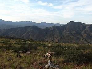
The trail drops down the other side of the saddle a short bit before swinging westward, working parallel to the creek, and using some switchbacks on steeper downhill sections. Before heading into the creek valley proper, Deadman Trail first aims for a low part on the northern rim, losing over five hundred feet along the way. There is another fence to hop over at the low part and some tricky route-finding - continue west further than you think you should to stay on track. At 1.9-miles, the trail finally bends south and gets serious about descending into the creek valley. It isn't steep enough to warrant switchbacks, instead merely carving a reasonable slope into the side of a drainage much of the way. In fact, there are some sections that may even appear to be fairly level. The drainage opens up, and the trail wanders onto a flat between two rocky washes, dropping into the western one right before Deadman Creek. A few cairns lead over to the creek at 3.1 miles. Directly across the creek from here is an old corral - the trail continues a few hundred yards upstream from this. The bank here may be overgrown, pick a path that works for you. Once past the thicker stuff, try to pick up the cairns, which are sparsely placed through the grassy lands, and do your best at following the tread. It is not as well-defined on this side of the creek, though the vegetation is not the worst to bushwhack through. Continue uphill and cross multiple drainages on a southeast diagonal before summiting the southern rim at 4.7-miles. The southern views are phenomenal. The final leg is a drop to meet up with Davenport Trail. For a while, the path sticks to the west side of a drainage. Then slides onto a narrow ridge between the drainage and the next one over, before swinging back to the original drainage for the last bit. Some areas of the leg are easy to follow. Some will require a bit of searching. The southern end of the trail is barely discernible. From here, one could head east less than a mile to Club Cabin for a water refill or head west either following Davenport Trail out of the wilderness or connecting with Sheep Creek Trail for more fun in the western Mazzies. Water Sources Deadman Creek at the trail crossing appears to be dependable. Mountain Spring, and Club Spring, near opposite trailheads are very dependable. Camping Club Cabin and Mountain Spring are well-known and built-up campsites (relative to the Mazatzals) with adequate water. One could camp along Deadman Creek near the corral, though there was no sign of a fire ring or flat for convenience. Check out the Official Route and Triplogs. Note This is a moderately difficult hike. Leave No Trace and +Add a Triplog after your hike to support this local community. One-Way Notice This hike is listed as One-Way. When hiking several trails on a single "hike", log it with a generic name that describes the hike. Then link the trails traveled, check out the example. | ||||||||||||||||||||||||||||||||||||||||||||||||||||||||||||||||||||||||||||||||||||||||||||||||||||||||||||


