|
tap row or icons for details
|
| Distance One Way |
|
0 miles |
| Trailhead Elevation |
|
14,168 feet |
| Interest Peak | | Dogs not allowed |
| | |
|
|
|
list |
map |
done |
South Region |
| | |
|
| |
|
|
Historical Weather |
| Trailhead Forecast | | |
|
 |
|
|
| Preferred Jul, Aug, Jun, Sep |
|
|
| | |
| |
Named Locations Coordinate Links
| |
|
| help future hikers |
| post a gps route now |
| | |
| |
|
|
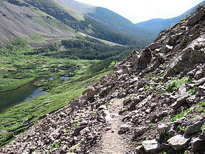
 Overview: Overview: Crestone Needle is one of the fourteeners of Colorado, in the heart of the Sangre de Cristo Range. It is part of a group of four fourteeners known as "the Crestones", headed by Crestone Peak (0.6 miles/1 km northwest of Crestone Needle) and also including Kit Carson Mountain and Humboldt Peak. While not as high as Crestone Peak, and connected to it by a high, jagged ridge, Crestone Needle is regarded as a worthy climb in its own right. The easiest route is the South Face (or South Couloir), usually accessed via Broken Hand Pass from South Colony Lakes. This is an exposed scramble with a few tricky moves, and is one of the more difficult standard routes among the Colorado fourteeners. However the classic route on the mountain is the Ellingwood Arete, also known as the Ellingwood Ledges Route. This is a steep ridge on the northeast side of the peak, leading directly up from the Upper South Colony Lake basin to the summit. It is a mildly technical rock climb (5.7 on the Yosemite Decimal Scale). It is particularly popular because of its inclusion in the well-known book Fifty Classic Climbs of North America by Steve Roper and Allen Steck. One-Way NoticeThis hike is listed as One-Way. When hiking several trails on a single "hike", log it with a generic name that describes the hike. Then link the trails traveled, check out the example. |
 Route Editor


