| Guide | ♦ | 3 Triplogs | 0 Topics |
details | drive | no permit | forecast | route |
stats |
photos | triplogs | topics | location |
| 21 | 3 | 0 |
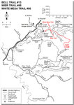
Rock the Casner by HAZ_Hikebot  The White Mesa Trail starts on the west side of Casner Canyon with Casner Butte Visible on the east side of the drainage. The Casners were a family who homesteaded on the south side of Wet Beaver Creek in the 1870s and have several landforms in the Verde Valley named after them. The trail enters the Wet Beaver Wilderness (closed to the use of motorized equipment and mechanized transport, including bicycles) and passes through typical upper Sonoran vegetation, consisting of prickly pear, agave, and juniper. The White Mesa Trail starts on the west side of Casner Canyon with Casner Butte Visible on the east side of the drainage. The Casners were a family who homesteaded on the south side of Wet Beaver Creek in the 1870s and have several landforms in the Verde Valley named after them. The trail enters the Wet Beaver Wilderness (closed to the use of motorized equipment and mechanized transport, including bicycles) and passes through typical upper Sonoran vegetation, consisting of prickly pear, agave, and juniper.The intermittent flow of water in Casner Canyon has exposed several of the geologic layers found in many of the canyons of the colorado Plateau. The pinkish-colored rock layer seen at the bottom of the canyon is part of the Supai Formation, deposited over 250 million years ago. Overlying the Supai Formation are the Toroweap Formation, Coconino sandstone, and the Kaibab Formation. Basaltic flows from volcanic activity to the north are visible as the top layer.
Gate Policy: If a gate is closed upon arrival, leave it closed after you go through. If it is open, leave it open. Leaving a closed gate open may put cattle in danger. Closing an open gate may cut them off from water. Please be respectful, leave gates as found. The exception is signage on the gate directing you otherwise. Check out the Official Route and Triplogs. Leave No Trace and +Add a Triplog after your hike to support this local community. One-Way Notice This hike is listed as One-Way. When hiking several trails on a single "hike", log it with a generic name that describes the hike. Then link the trails traveled, check out the example. | ||||||||||||||||||||||||||||||||||||||||||||||||||||||||||||||||||||||||||||||
 Route Editor


