 Route Editor

| Guide | ♦ | 3 Triplogs | 0 Topics |
details | drive | no permit | forecast | route |
stats |
photos | triplogs | topics | location |
| 11 | 3 | 0 |
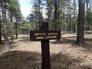
 Griffith's Spring is a shaded and peaceful one-mile loop trail that is close to Flagstaff and is an excellent example of a riparian habitat. James Griffith was a Civil War veteran that came west to homestead in the late 1800s. The spring was part of the homestead which consisted of over 160 acres of diverse countryside. Griffith's Spring is a shaded and peaceful one-mile loop trail that is close to Flagstaff and is an excellent example of a riparian habitat. James Griffith was a Civil War veteran that came west to homestead in the late 1800s. The spring was part of the homestead which consisted of over 160 acres of diverse countryside.Following the trail to the right at the beginning of the loop, you'll walk through a Ponderosa pine forest on a wide, well-maintained path. The trail follows a small canyon to a tank that forms a stream in the late summer months after heavy rains. Near the stream, you may see wild iris, and lupine and hear western bluebirds, robins, and hummingbirds. Continuing up the trail a short distance you'll find Griffith's Spring. This spring runs into Pump House Wash, then eventually into Oak Creek. There is a board crossing the spring, but you will turn around and rejoin the trail going to the right to complete the loop.
Check out the Official Route and Triplogs. Leave No Trace and +Add a Triplog after your hike to support this local community. One-Way Notice This hike is listed as One-Way. When hiking several trails on a single "hike", log it with a generic name that describes the hike. Then link the trails traveled, check out the example. | |||||||||||||||||||||||||||||||||||||||||||||||||||||||||||||||||||||||||


