| Guide | ♦ | 10 Triplogs | 0 Topics |
details | drive | permit | forecast | route |
stats |
photos | triplogs | topics | location |
| 0 | 10 | 0 |
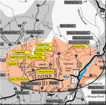
short and stout by HAZ_Hikebot  The Teacup Trail, mostly un-shaded, meanders west past the base of Coffee Pot Rock and climbs moderately to the base of Sugarloaf Hill to the south. On the south side of the Sugarloaf Loop Trail, you can take the Summit Trail to climb 250 feet to the top of this hill for marvelous panoramic views. The Teacup Trail continues southwest a bit further to the Sugarloaf Trailhead parking area, 1.8 miles from the Soldier Pass area. The Teacup Trail intersects the Thunder Mountain Trail, the link to the western portion of the "North Urban Trail System - West", 0.3 miles north of the Sugarloaf Trailhead. The Teacup Trail, mostly un-shaded, meanders west past the base of Coffee Pot Rock and climbs moderately to the base of Sugarloaf Hill to the south. On the south side of the Sugarloaf Loop Trail, you can take the Summit Trail to climb 250 feet to the top of this hill for marvelous panoramic views. The Teacup Trail continues southwest a bit further to the Sugarloaf Trailhead parking area, 1.8 miles from the Soldier Pass area. The Teacup Trail intersects the Thunder Mountain Trail, the link to the western portion of the "North Urban Trail System - West", 0.3 miles north of the Sugarloaf Trailhead.Check out the Official Route and Triplogs. Leave No Trace and +Add a Triplog after your hike to support this local community. One-Way Notice This hike is listed as One-Way. When hiking several trails on a single "hike", log it with a generic name that describes the hike. Then link the trails traveled, check out the example. | |||||||||||||||||||||||||||||||||||||||||||||||||||||||||||||||||||||||||||||||||||||||||||||||||||||||||||||||||||||||||||||||||||||||||||||||||||||||||||||||||
 Route Editor


