Route Editor

| Guide | ♦ | 15 Triplogs | 0 Topics |
details | drive | permit | forecast | 🔥 route |
stats |
photos | triplogs | topics | location |
| 148 | 15 | 0 |
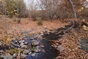
Look out for javelinas by kyleGChiker  Overview OverviewThis is a fantastic hike (backpacking) that checks all the boxes of beautiful scenery, pristine desert, a short drive from Phoenix, fairly reliable water, and nice trails that are easy to follow and in good condition. The core of the loop consists of Cave Creek Trail #4 and Cottonwood Trail #247. There are two options for trailheads: 1) Spur Cross Trailhead and 2) Cave Creek Trailhead. This loop makes a nice two or three-day backpacking trip. Please check the water sources carefully before leaving, but there seems to be fairly reliable water at several places along this loop. (Note: I did the loop from the Cave Creek TH, but since Spur Cross is more popular, I'm writing the guide from that starting location). Hike As for the details of the hike, the first portion follows the Spur Cross Trail from the parking area to the edge of the Spur Cross Conservation Area. At about 2.2 miles, you will leave the Spur Cross Conservation Area and enter Tonto National Forest. Here, after crossing the creek, you will find a large sign for Skull Mesa Trailhead. You could drive to this trailhead many years ago, but now it is hiking access only. From here, follow Cave Creek Trail #4 for 9.2 miles till you get to the junction with the Cottonwood Trail #247. I recommend reading @FourPeaks well-written guide for Cave Creek #4 to Spur Cross TH. Albeit in reverse for our purpose, the beta is excellent.
When reaching the ridgeline, the trail will become a little more narrow as it climbs slowly while traversing up and down with the terrain. Enjoy the scenic views looking up at the mountains to your right and down into the valley on your left. In this area, it is common for cattle to be grazing. Please be safe and don't approach them or bother them. After several miles continuing up this valley, you will reach the junction with the Bronco Trail #245, which leads out to the Bronco Trailhead (along 7 Springs Road). Here our trail makes a 90-degree bend, so take a right to continue on the Cottonwood Trail, which begins a short but steep climb. When you reach the top, relax and breathe easy because you've just reached the highest point on the whole loop. It's all downhill from here (well, not really, because there is always up and down, but from here to your trailhead at Spur Cross is almost 1,500 feet downhill). From here, for the next 5 miles, you'll first be hiking along Quien Sabe Peak on your right, and then Skull Mesa, also on your right. You'll lose 1,000 feet of elevation too. Be sure to watch for javelinas, which are very common in this area. The reason this point, 5 miles later, is significant is the location of Cottonwood Spring (at 33.646585 and -111.558573). Cottonwood Spring makes a good overnight stop if you are backpacking due to the typically reliable water. However, please don't depend on it in the summer unless you have recent water reports, but the rest of the year, it should be flowing. Watch for wildlife in this area, as water always attracts the animals and birds. From the spring, you'll climb 300 feet up to a very nice viewpoint, then drop another 800 feet down to the junction with the Cave Creek Trail. At this point, you've completed the loop portion and have 2.2 miles back to your car at Spur Cross. A few other points of interest on the loop: Crested Saguaro #1: 33.966783, -111.899783 Crested Saguaro #2: 33.914067, -111.9204 Water Sources Cave Creek itself is fed by many springs and flows most of the year. However, be aware, sometimes it flows underground. Along the Cave Creek Trail, you'll join up with the creek about 3.5-4 miles before the junction with Cottonwood. If there's water here, there will be water all the way to Cottonwood. There is nice camping all along here, including before the first crested saguaro next to a large pool (large enough to swim in). Cottonwood Spring is the only other water source on this hike, and it may be unreliable. Ensure you carry enough water and know the status of these water sources before heading out for a multi-day adventure. Final Note I posted my GPS Route for this hike only for supplemental information. Three differences: 1) I started at Cave Creek TH, not Spur Cross TH. 2) I hiked the loop counter-clockwise rather than clockwise as described above. 3) There was a hiccup with my GPS recording, and it got paused for about 1.5 miles at the north end of the Cottonwood Trail. I posted it in case you can get value from it, but I'd refer you to the Official Route by @HAZ_Hikebot. Check out the Official Route and Triplogs. Leave No Trace and +Add a Triplog after your hike to support this local community. | |||||||||||||||||||||||||||||||||||||||||||||||||||||||||||||||||||||||||||||||||||||||||||||||||||||||||||||||||||||||||||||||||||||||||||||||||||||||||||||||||||||||||||||||||||||||||||||||||||||||