Route Editor

| Guide | ♦ | 5 Triplogs | 0 Topics |
details | drive | no permit | forecast | route |
stats |
photos | triplogs | topics | location |
| 133 | 5 | 0 |
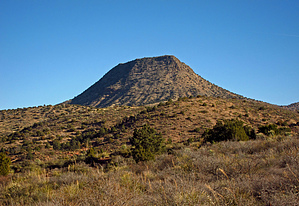
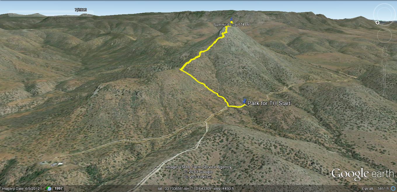
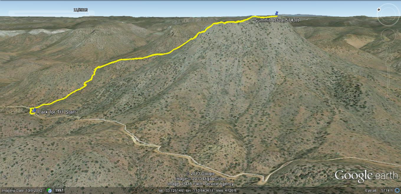
.. Elevation Profile & Pics Don't Lie .. by Grasshopper   Overview OverviewIn a less visited and very scenic eastern section of our Tonto National Forest bordering the Salt River Canyon Wilderness, for those qualified, an opportunity to "off-trail" summit one of the areas more visible and dominant Benchmark Buttes at 5741 feet elevation. Warning This is a rugged and completely "off-trail" heavy vegetation, rocky, steep up & downhill summit hike for advanced experienced hikers with advanced route-finding skills. It is highly recommended to download and closely follow the authors posted 1/21/13 GPS Route (which may or may not be the best hiking route for this summit hike, but is one successful way to "out and back" Haystack Butte from FR303). Good hiking boots, long pants, and gloves are recommended. It should also be noted that this hiking route does not have any available perennial water sources but does have morning and afternoon sun exposure to take into consideration for our warmer hiking months.
This completely "off-trail" hike begins at a small one-vehicle pull-off/park location 13.3 miles in on FR303-Haystack Butte Road. After a short ~100-yard walk further up FR303, the official TH Start for this hike begins at a visible FR303 east drainage area. Begin hiking east up this drainage for fifty(50) feet and cross over a ranching fence to continue. At the top of this drainage .40 miles in you will arrive at the Lower Ridgeline Saddle area. Take a right(south) turn here and continue hiking along a vague animal use route that follows the Haystack Butte Lower Ridgeline and fence line up to near the fence line end at its stopping point- The Haystack Butte cliffs area. If you are following the author's posted 1/21/13 GPS Route, you will now be into the required "off-trail" bushwhacking adventure which traverses around and up the SW side of Haystack Butte to eventually summit Haystack Butte's steep and rocky Upper Ridgeline at ~1.02 miles in (at 5679ft). Here, as of this writing, the author has placed a "key" large rock cairn (at waypoint location N33.72617 W110.63871) to indicate the correct arrival and exit point for this Upper Ridgeline hiking route. Hiking south from this location along this narrow Upper Ridgeline you will experience some very scenic near and distant 270-degree views. You will also experience 3-4 minor false summits before arriving at the official south end Haystack Butte BM Summit at 5741 feet. The Summit Register and Official Summit BM are located under a small rock cairn at N33.72407 W110.63723 Water Sources None Camping Not Recommended
Check out the Official Route and Triplogs. Note This is a moderately difficult hike. Leave No Trace and +Add a Triplog after your hike to support this local community. | |||||||||||||||||||||||||||||||||||||||||||||||||||||||||||||||||||||||||||||||||||||||||||||||||||||||||||||||||||||||||||||||||||||||||||||||||||||||||||||||||||||||||||||||||||||||||||||||||