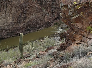
Canyons are inherently risky. Flash floods occur without notice on sunny days. Technical skills & surrounding topography knowledge required yet does not eliminate risk. |
|
tap row or icons for details
|
| Distance One Way |
|
0 miles |
| Trailhead Elevation |
|
1,920 feet |
| Interest Off-Trail Hiking & Seasonal Creek | |
| | |
|
|
14 |
2021-11-27 |
|
|
|
10 |
2016-12-08 | MountainMatt |
|
|
14 |
2016-12-03 |
Hells Half Acre Lasso Loop |
BiFrost |
|
|
|
21 |
2015-12-05 |
Hells Half Acre Lasso Loop |
The_Eagle |
|
|
|
15 |
2015-12-05 |
Hells Half Acre Lasso Loop |
joebartels |
|
|
|
22 |
2013-02-02 |
Burro Creek - Kaiser Roll Canyon Loop |
joebartels |
|
|
|
25 |
2013-02-02 |
Burro Creek-Kaiser Canyon Loop |
The_Eagle |
|
|
|
35 |
2012-12-27 |
Joshua Forest Scenic Parkway |
Randal_Schulhaus |
|
|
| |
|
| |
|
|
Historical Weather |
| Trailhead Forecast | | |
|
 |
|
|
| Preferred Mar, Nov, Feb, Dec |
|
|
| | |
Named Locations Coordinate Links
| |
|
| Burro Creek
|
16.36 mi
1,588 ft |
|
|
| Hells Half Acre Lasso Loop
|
17.04 mi
1,959 ft |
|
|
| Hells Half Acre Lasso Loop
|
17.97 mi
2,093 ft |
|
|
| Hells Half Acre Lasso Loop
|
17.58 mi
2,052 ft |
|
|
| Burro Creek-Kaiser Canyon Loop
|
19.06 mi
2,317 ft |
|
|
| | |
| |
|
|
Happy Trails!
|
 Route Editor