username
X
password
register
for free!
help
  

Sharktooth Beach Trail, GA

Guide 0 Triplogs  0 Topics
  0 of 5  
Fav
Wish
0
details
drive
permit
forecast
map
stats
photos
triplogs
topics
location
0 0 0
Statistics
tap row or icons for details
Difficulty 2.5 of 5
Route Finding 3 of 5
Distance Round Trip 2 miles
Trailhead Elevation 9 feet
Avg Time Round Trip 2 hours
 Interest Off-Trail Hiking
 Backpack No
Post the 1st photoset!
Author
author avatar Guides 7
Routes 0
Photos 99
Trips 2 map ( 3 miles )
Age 47 Male Gender
Location Satilla River Basin, GA
Associated Areas
list map done
Costal Region
Historical Weather
Trailhead Forecast
Expand Map
Preferred Feb, Mar, Nov, Dec → 6 AM
Seasons   ALL
Sun  6:05am - 6:42pm
0 Route
 
0 Alternative


Tidal Marshland Hiking
by satillayakker

Sharktooth Beach Trail is definitely not your "normal" trail, if there is such a thing. The trailhead is pretty much the norm though. You have to park by a paved road where there is a gate to an access road. This access road is used still by the Jekyll Island Authority (The state governing entity for the island). The gate is usually locked, but there is a footpath entrance next to the gate. For the first half mile, there is nothing too fancy. A grassy trail closed in by pines, cedars and wax myrtle. Several places give you a view of a salt marsh as you walk out the trail.


After the first half mile or so, you come to a sharp right turn in the trail. This is NOT where you want to go. Sharktooth Beach Trail turns left here and makes its way across a salt marsh. It is pretty tough to see the trail as it moves to the marsh, but with decent route finding skills you should be ok. Once the trail enters the marsh, it is pretty easy walking for the most part. You do find yourself traversing through and occasional brush patch (I don't know what they are, but they give cats claw a run for the money!) and mud. But most of the trail is soft, white, slightly compacted soil. The only way to know if you are on the trail is to look way ahead, find a spot where the trail is in the next brush patch and aim in!
remove free decal offer
Along the trail you will see seemingly infinite deer tracks. Deer and raccoons are all over the marsh. I even saw bobcat tracks. Also, we saw literally millions of fiddler crabs! (Note: Once you do enter the marsh, you will see an island of trees. Sharktooth Beach is on the left side.) Once you finally arrive at Sharktooth Beach at the Jekyll River, if it is low tide, you can sometimes find shark teeth at the low water line. the beach is made up of oyster and clam shells bleached by the sun. If you are expecting a white sandy beach, disappointment awaits. But, it is a very beautiful and peaceful hike either way. Just be warned. This hike is extremely hot in the summer and very, very humid! There is no shade once you turn into the marsh and the 90%+ humidity only helps to hold the heat in your body. Temps on the marsh flats can easily get well over 100. Add that with the humidity and it can quickly spell disaster! Plenty of water and cool, "airy" clothing can help tremendously. Go early in the morning or very late in the evening.

Jekyll Island is not a State Park, but it does collect a "parking pass" fee for entrance.

Gate Policy: If a gate is closed upon arrival, leave it closed after you go through. If it is open, leave it open. Leaving a closed gate open may put cattle in danger. Closing an open gate may cut them off from water. Please be respectful, leave gates as found. The exception is signage on the gate directing you otherwise.

2013-09-03 satillayakker
  • Area Map
    guide related
    Area Map

Leave No Trace and +Add a Triplog after your hike to support this local community.
WARNING! Hiking and outdoor related sports can be dangerous. Be responsible and prepare for the trip. Study the area you are entering and plan accordingly. Dress for the current and unexpected weather changes. Take plenty of water. Never go alone. Make an itinerary with your plan(s), route(s), destination(s) and expected return time. Give your itinerary to trusted family and/or friends.

 Permit $$
information is in description


 Directions
or
 Road
Paved - Car Okay

To hike
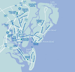
From Brunswick GA, follow the signs to Jekyll Island. Once you cross the bridge onto Jekyll Island, turn right at first road. (South Riverview Drive.) Follow until you pass Summer waves water park. Trail is on right at closed metal gate.
page created by satillayakker on Sep 03 2013 7:05 am
 90+° 8am - 6pm kills
helpcorrectionissue

end of page marker